Iconic waterfalls in Iceland
Iconic waterfalls in Iceland, geology, history, and how to get there
With more than 10,000 waterfalls, Iceland never ceases to amaze with its iconic waterfalls. While travelling within Iceland, you will see a lot of waterfalls. On almost every cliff you will see a waterfall fed by a glacier.
From smaller ones to the most powerful ones, you will feel like you are on another planet. Even though people say that many of them do not even have a name, this is not true. If you ask the locals about the name they will know it.
Check out this map to find the exact location of the waterfalls mentioned in this blog.
The beauty of Iceland’s waterfalls fascinated movie producers and many of them chose some waterfalls as filming locations for scenes in movies and series like “Game of Thrones”, “Land ho!”, “Thor”, “The Secret Life of Walter Mitty” and many more.
Many waterfalls have some interesting stories that you will find out in this blog.
Seljalandsfoss
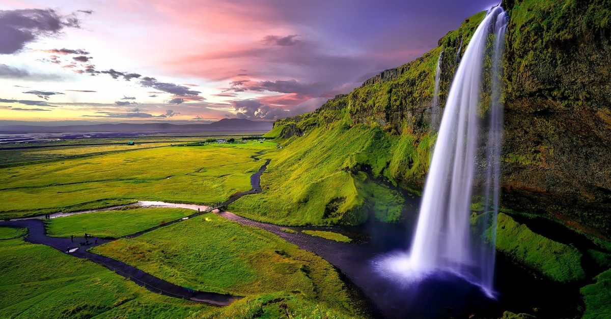
After two hours of driving from Reykjavik on Route 1, you will find one of the most beautiful waterfalls in south Iceland, Seljalandsfoss. The waterfall is close to the main road so it will be easy to find it.
Near the waterfall is a parking lot where you can park your car for a small fee. Be careful during the wintertime, the path behind the waterfall is usually closed because of safety reasons. Do not adventure there as it can be really dangerous.
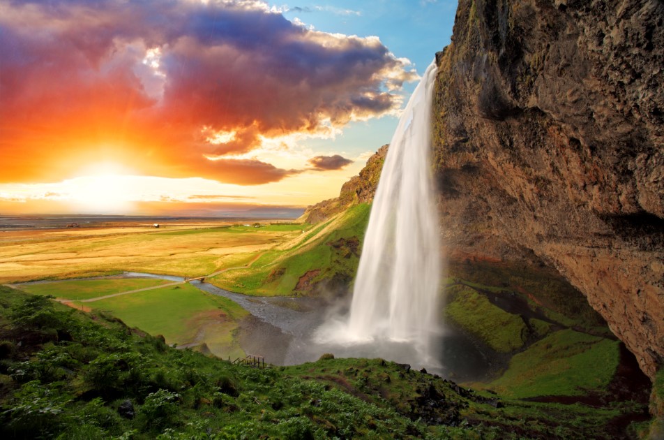
The waterfall is a part of the river Seljalandsá that has its origins underneath the glacier Eyjafjallajökull-the famous volcano that erupted in 2010 and blocked the airports in Europe. The waterfall is 60 m (200 feet) high and falls from a cliff that once was the country’s coastline.
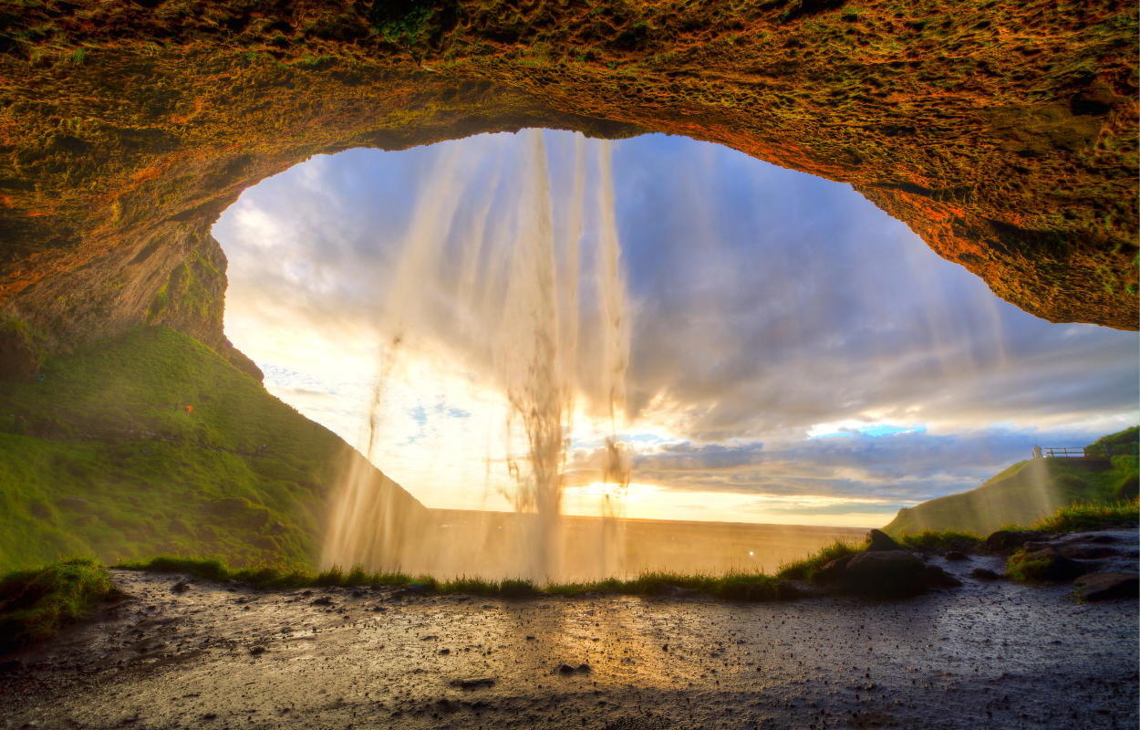
This waterfall has its beauty especially because the cliffs behind the fall were carved through time and now there is a path that goes behind the waterfall. Visit Seljalandsfoss waterfall on a private tour in South Iceland.
Skógafoss
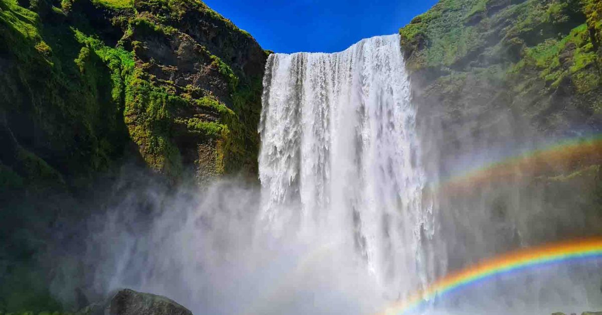
Another landmark and one of the most photographed waterfalls in Iceland is Skógafoss. It is one of the biggest waterfalls in Iceland with a 25 meters’ width and a drop of 60 meters.
Due to the sunlight and the spray that water produces, there are almost rainbows that can be seen on the wall created by the water falling.

The waterfall has its origins in the Skógá River. On this river is a large char and salmon population.
According to legend, the first Viking settler in the area buried a treasure in a cave behind the waterfall. The legend continues that locals found the chest years later but were only able to grasp the ring on the side of the chest before it disappeared again.
The ring was allegedly given to the local church. The old church door ring is now in the Skógar Museum. Believe it or not, if you got close enough to the waterfall you might be able to see the treasure chest.
You can see the Skógafoss waterfall from the top. There is a staircase that leads to the top of the waterfall which is also a belvedere platform. Also when you wander around Skógafoss respect the signs and do not get too close to the waterfall.
How to get there: Skógafoss waterfall is also visible from Route 1 so it is impossible to miss it. You also have a car park near the waterfall. Visit Skógafoss waterfall on a self-drive tour in South Iceland.
Svartifoss
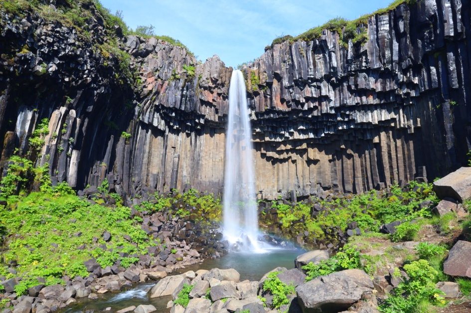
While wandering in South Iceland, you can go to Skaftafell National Park to see the Svartifoss waterfall. A 20m (80ft) tall waterfall fed by the ice-cold water from the Svinafellsjokull glacier.
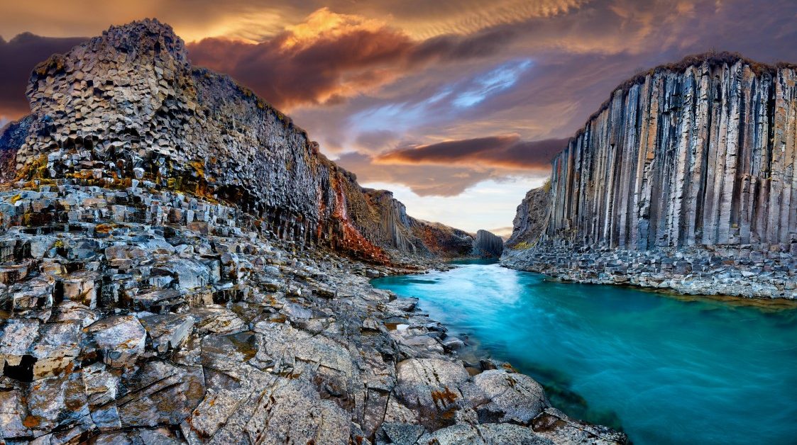
The name of the waterfall translates to ‘Black waterfall’ given by the colour of the basalt columns that stand tall and form the cliff.

Icelanders say that the natural architecture given by the basalt columns from this waterfall inspired the architect Guðjón Samúelsson who designed Iceland’s National Theatre and the Hallgrimskirkja church in Reykjavik. The basalt columns formed from a lava flow which cooled slowly and formed the hexagonal shape.
To get to the Svartifoss waterfall, you have to hike from the Visitor Centre in Skaftafell where you can also find information about the waterfall and the National Park. The hike will take about 45 minutes one way, about 1.6 km to the waterfall.
Along the trail to the waterfall, you will find three small waterfalls – Þjofafoss, Hundafoss, and Magnusarfoss. Near the Svartifoss waterfall, there is a small bridge across the river. The hike to the waterfall is free but you will need to pay for parking at Skaftafell National Park.
Once you get to the waterfall, you can go as close as it is safe to take pictures of the waterfall without crossing the boundaries set up by the park.
On the way back if you choose to cross the bridge by Svartifoss, along the trail you will find Selið turf houses which are built in southern style. The locals say that those are the few turf houses that remain in South Iceland.
Dynjandi
The most majestic waterfall in Iceland and Westfjords, Dynjandi is also called the jewel of Westfjords.
Located by Dynjandisvogur Bay and Arnarfjörður fjord in Westfjords, Dynjandi is fed by waters from lake Stóra-Eyjavatn which is 350m above sea level. From this lake runs the Dynjandisá river which sometimes can cause seasonal floods during spring and winter.
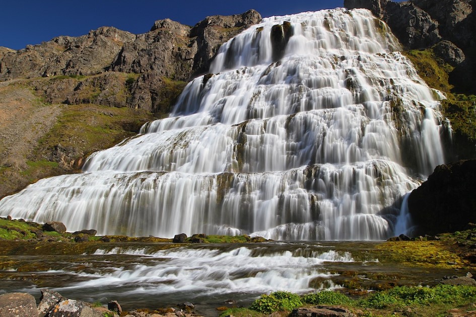
The waterfall has a trapezoidal form 30 meters wide on top and widens to 90 meters at the bottom. On your way to Dynjandi, you will find another 6 small waterfalls. There are also a couple of smaller waterfalls above Dynjandi.
On the parking lot, where you will start your hike to Dynjandi, you will find a map and information about all the waterfalls existing along the way. You can stop to admire each one as there are appointed places with observation points. To reach Dynjandi, you have to hike for about 15 minutes on a path made by volunteers in 1996.
Bear in mind that the terrain is pretty steep and if your knees are not in good condition, it will be hard for you to hike to the waterfall. These are the names of those waterfalls you will find along the path: Hæstahjallafoss; Strompgljúfrafoss (Strompur); Göngumannafoss; Hrísvaðsfoss; Kvíslarfoss; Hundafoss; Bæjarfoss (Sjóarfoss).
The name Dynjandi translates as thunderous or resounding. The waterfall is also preserved as a natural protected monument since 1981 that’s why you have to follow the path to the waterfall and be careful with the environment there and in Iceland in general.
To reach Dynjandi from the south part as you come north from Reykjavik, you have to turn left from Route 1 to Route 60 and follow it to Westfjords. Then, when you get to the Dynjandisheiði heath turn left to a gravel road to get to the bottom of the waterfall. The drive from Reykjavik to Dynjandi waterfall takes about 5 to 6 hours.
It is not recommended to drive it from Reykjavik in one go. Roads in the west fjords can be tricky during winter. Be sure to check the weather and road conditions beforehand.
Visit the majestic Dynjandi on a self-drive tour around Iceland.
Hraunfossar
Located near the town of Borganes, Hraunfossar is a very interesting attraction and that’s because of the geology of the waterfall.
The Hraunfossar is formed by a series of waterfalls that are origins by rivulets streaming out of the Hallmundarhraun lava field over a distance of about 900 m (2952 ft).
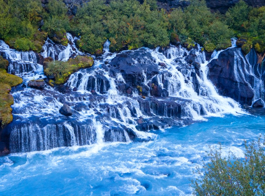
The name of the waterfall means ‘Lava Falls’ from the Icelandic word for lava ‘hraun’ and waterfall ‘foss’.
The lava field was formed after the eruption of one of the volcanos that lie under the glacier of Langjökull which is the second-largest ice cap in Iceland. The waterfalls pour into a river called Hvítá in Borgarfjörður.
The area around Hraunfossar changed constantly because of the eruptions and that caused the formation of some caves. The longest lava cave in Iceland, Víðgelmir, can be found near the waterfall.
The geology of the cave is unique as it was formed just one thousand years ago and its human history is closely related to folklore. It is believed that the cave is home to trolls. Near the Hraunfossar can be found also Barnafoss waterfall.
To get to the Hraunfossar you have to drive one hour and a half north on Route 1 and when you get to Borganes you follow road 50.
Gljufrabui
At less than a 10-minute walk north from Seljalandsfoss, there is a hidden gem inside a grot (or canyon). Gljufrabui is a spectacular waterfall hunted by all photographers who come to Iceland. Take your waterproof equipment and clothes because you will get wet there.
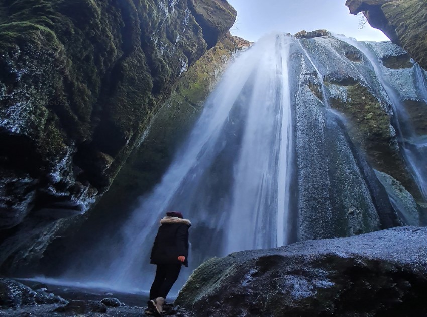
The view of running water down to the rocky walls is stunning. This waterfall is hidden in a canyon. To get there you need waterproof shoes and clothes as you will get wet going inside the canyon. Check if your photo gear is waterproof, if not be careful, it gets wet and your gears can be damaged.
Also, be careful in wintertime, everything may be frozen and it can be dangerous to get inside there. And I am saying this from my own experience, I slipped and fell at the entrance of the canyon and my back hurt for like two weeks, so be careful, as I said before, you do not want to put your life in danger for an Instagram photo.
Goðafoss
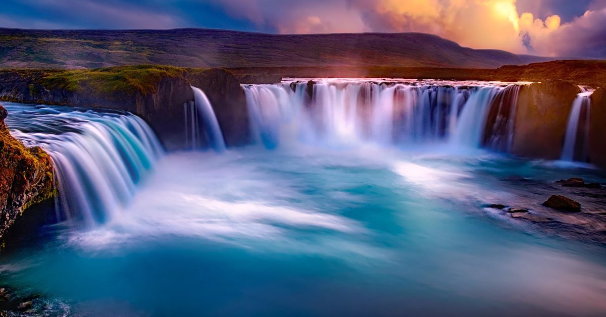
Goðafoss waterfall is another majestic waterfall you will find in Iceland. Located almost near the Dettifoss waterfall, Goðafoss is located on the fourth largest river in Iceland, Skjálfandafljót.
It is considered one of the most spectacular waterfalls in Iceland with a height of 12 meters (39 feet) and a width of 30 meters (98 feet).

The name of the waterfall means “waterfall of Gods” or the “waterfall of Priest” and its history is centred around the Old Norse religion. History says that back in time, in the 9th and 10th centuries, the majority of the settlers of Iceland were Norwegians who followed the Old Norse religion. After the Commonwealth was established in 930 AD, the pressure of converting to Christianity that came from Europe was felt also by the settlers.
To prevent the Norwegians from occupying the whole country, the Icelanders wanted to decide about the religion they would accept for their country.
At Þingvellir, a year-long meeting was held to discuss the problems of the country, there was founded the first parliament in Iceland in 930 AD. To solve this issue, the responsibility of making the decision was given to the Ásatrú priest (or goði) Þorgeir Ljósvetningagoði.
The legend says that he lay under a fur blanket for a day and a night and prayed to his Old Gods to make the right decision. After that, he came and decided that for the good of the people, Christianity would be the official religion of the country but the pagans could practice their religion in private.
After his decision, he returned to his home in North Iceland, and to symbolize that he would continue to believe in his Old Gods, he threw idols of the Old Gods into the beautiful waterfall that is named today Goðafoss waterfall.
Like Dettifoss, Goðafoss waterfall is also located on the Diamond Circle, in North Iceland on the Ring Road route. Both waterfalls mentioned are located close to each other.
Goðafoss waterfall can be reached throughout the year, but during the wintertime, you will need a four-wheel-drive vehicle. Visit Goðafoss waterfall on a self-drive tour around Iceland.
Dettifoss
Dettifoss Waterfall is known to be one of the most powerful waterfalls in Europe. It is located in the North of Iceland in Diamond Circle near the towns of Akureyri and Húsavík. Between Akureyri and Detifoss is the Mývatn geothermal area.

The water that fed the Detifoss waterfall comes from the glacier river Jökulsá á Fjöllum. This river has its origins in the largest glacier in Europe, Vatnajökull.
The average water flow of the Dettifoss waterfall is about 193 meters cubed (6,186 cubic feet) per second. The waterfall is 100 meters (330 feet) wide and then plummets about 45 meters (150 feet) into the Jökulsárgljúfur canyon.
Being fed by a river with origins in Vatnajökull National Park, the waterfall is also a part of the National Park therefore it is protected.
The beauty of Dettifoss inspired the producers of the movie “Prometheus” and the scenes filmed at the waterfall were about the beginning of the world. The majestic waterfall has also very photographed by professional and amateur photographers.
Down on the river, south of Detifoss Waterfall, you will find also Selfoss Waterfall.
You can find Dettifoss waterfall either on a Diamond Circle tour or on the Ring Road tour and of course, you can find it on your own on a self-drive tour in the North of Iceland.
Gullfoss
Gullfoss waterfall is one of the most popular waterfalls in Iceland mostly because of its location in the Southwest of Iceland on the Golden Circle route, a famous sightseeing route that many tourists choose to follow when they come to Iceland.
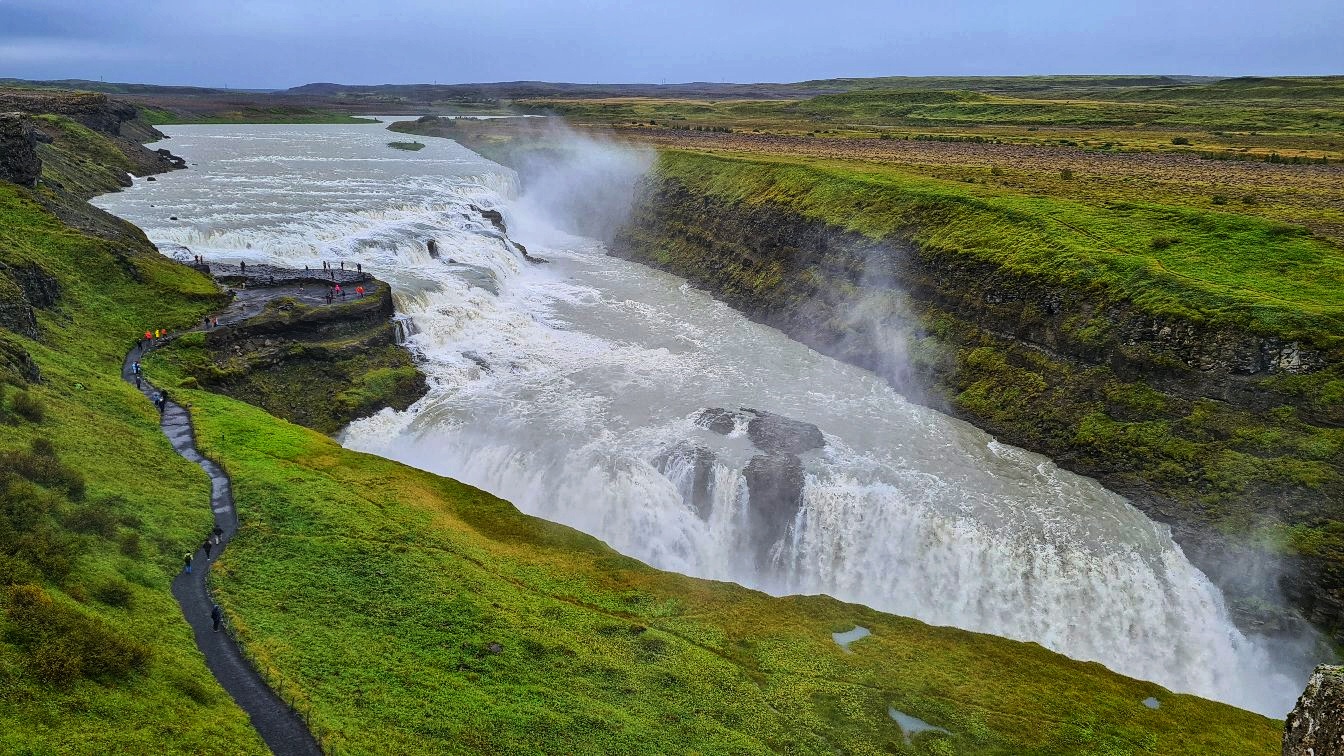
The waterfall is enormous. It was formed by floodwaters that forced their way through basalt lava columns and it has two falls, the smaller one is 11 meters (36 feet), and the second and the bigger one is 21 meters (69 feet). The water flow is different depending on the seasons.
Therefore, during the summer the water flow is about 140 cubic meters (459 cubic feet) every second and during the winter the water flow drops to about 109 cubic meters (358 cubic feet) every second.
Knowing this, you will not be surprised about the power of this waterfall and the water spray because of which you will need a rain jacket if you get too close.
Before flowing into the Hvítá River canyon, the Gullfoss waterfall is fed by the river with the same name as the canyon. Both walls of this canyon reach up to 70 meters in height (230 feet). Then the waterfall descends into the great Gullfossgjúfur canyon.
Gullfoss means “Golden falls”. The origin of the Gullfoss waterfall name has three stories: one says that the waterfall has its name from the golden hue that shines in its glacial waters under the sun.
The other story says that the name of the waterfall was given because of the rainbow that forms due to the water spray of the waterfall.
The third story of the waterfall name says that the name Gullfoss was found in a travel journal belonging to Sveinn Pálsson. According to the gullfoss.is, in the travel journal was written that: “Once upon a time, a farmer named Gýgur lived at Gýgjarhóll.
He had plenty of gold and could not bear the thought of someone else possessing it after his lifetime. To prevent this, he placed the gold in a coffer and threw it into the waterfall.”
The history of the Gullfoss waterfall is very interesting. There is a story about a girl named Sigríður Tómasdóttir who is considered to be the protector of the Gullfoss Waterfall. “She was born 24th of February 1871 and she died in the Autumn of 1957, aged 87.
She lived all her life in Brattholt, a farm that still exists today, and was the second eldest of 13 children born from Margrét Pórðardóttir, a housewife and Tómas Tómasson, a farmer on that same farm.” Gullfoss.is
Tourism around the Gullfoss waterfall started as far back as 1875 but access to it was difficult. Sigríður and her sisters often guided the tourists to the waterfall and also built the first trail to the waterfall.
At that time the waterfall was owned by Tómas Tómasson, Sigríður’s father. The waterfall became famous and because of its power, some foreign investors wanted to buy the land and use the waterfall as a power generator.
When Sigríður found out about this, she took the investors to the court and she fought to protect the waterfall, even threatening to throw herself in the river. She was helped in the court by a lawyer who later became the first president of an independent Iceland in 1944.
Their fight in the court against the investors had success and the investors gave up on their plan of buying the land and using the waterfall as a power generator.
After her efforts to protect the waterfall, Sigríður Tómasdóttir is one of the most famous figures in Iceland’s history. At the top of the Gullfoss waterfall, there is also a stone with a plaque detailing Sigríður’s story.
Gullfoss waterfall is visited on every Golden Circle tour. To get there you have to drive east from Reykjavik for about one hour and a half.
You can visit the waterfall every day from 9:30 to 18:30.


