Photographer’s paradise
Iceland: the photographers’ paradise, famous places, tips, recommendations
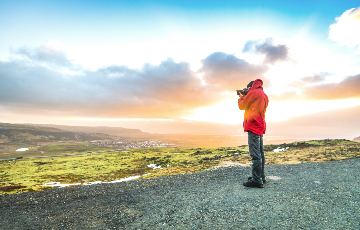
You probably have seen all over the internet that Iceland is known as the photographers’ paradise, especially because of those stunning photos taken in Iceland.
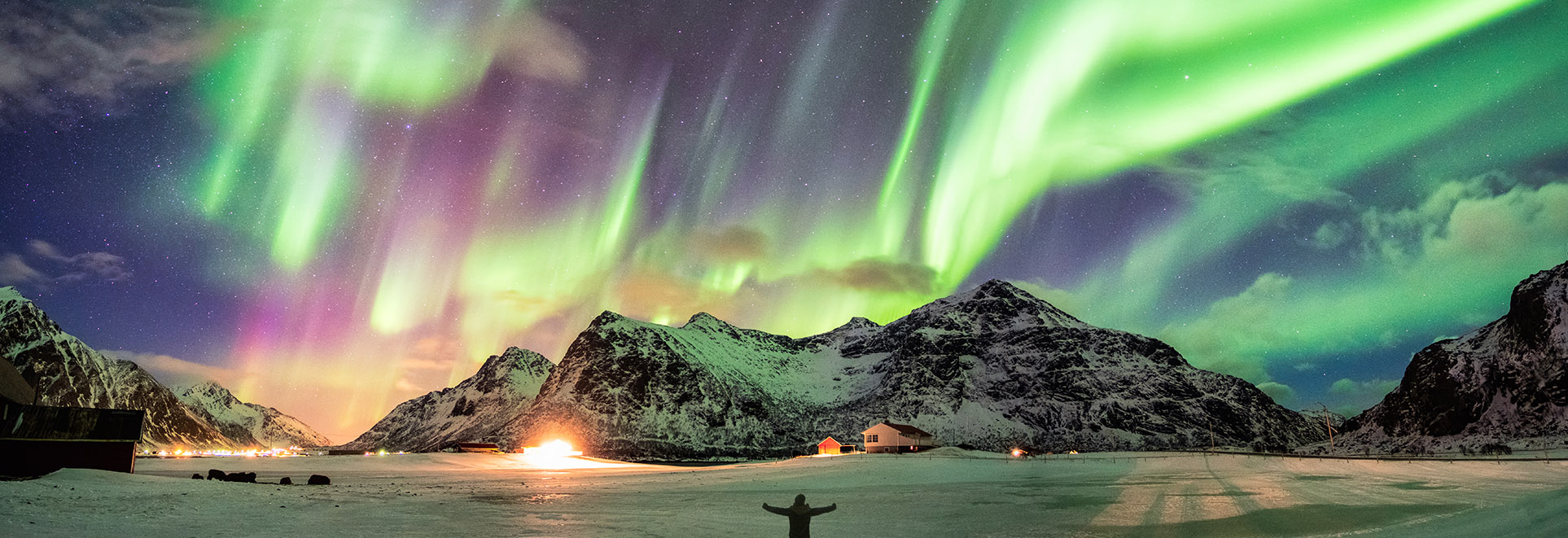
If you ever doubt it, then I should confirm that, yes, Iceland is a photographers’ paradise. Not only for the northern lights but Iceland has an amazing relief. Its geology is impressive.
Iceland is one of the most active volcanic regions on Earth and because of its relief, it is unique. From rift valleys, columnar basalt formations, geysers, hot springs, lava fields, rhyolite mountains, lunar-like craters, and also many glacial forms like glaciers, ice caves, glacier lagoons to black sand beaches, high mountains, fiords, and rocky stacks near the shoreline.
Also probably one of the most beautiful things that you will find in Iceland is wild fauna.
One of the most interesting things that makes Iceland the photographers’ paradise is that during the summertime the “golden hour” lasts the whole night. Sounds perfect right?
If I already intrigued you, let’s see where some of the best places for photography are located and how to get there.
After you wander around in the capital city, about a two-hour drive from Reykjavik, you can get to explore the Snæfellsnes peninsula. Here you will find a lot of impressive gems.
You will not resist photographing the wild fauna you will find in Iceland. Especially in the Snæfellsnes Peninsula. Ytri-Tunga is a sandy beach that has a little secret hidden away down by the sea, behind the farmhouses… a seal colony!
Seals love to spend their time on the rocks of this beautiful beach. They are friendly and curious and will climb up on the rocks for you to spot them from a distance.
The best time to see seals is during the summertime from May to July when the sea level drops and seals bask on the rocks.
The most common species you will see in Iceland are the Grey Seals and Sea Calf Seals. Do not expect them to be too visible as their fur can be confused with the seaweed on the rocks.
So, you will spot them on the rocks, but you will need binoculars or a telephoto lens to look at them closer. Try not to go too close to the seals if you are not familiar with their behaviours. They might attract if feel threatened.
How to get there: You will find Ytri-Tunga beach on the south coast of Snæfellsnes peninsula on Route 54. Pay attention, on the road, is a signpost that indicates when to turn off to get to the beach.
No photographer has been in Iceland and not photographing a classic Icelandic church or a Scandinavian black house. In the Snæfellsnes peninsula, you will find a black church that has been the subject of many impressive photos through time.
On the south coast of the peninsula, there’s a village with only a hotel and a tiny black church called the Búdakirkja that sits alone among a field of lava rocks.
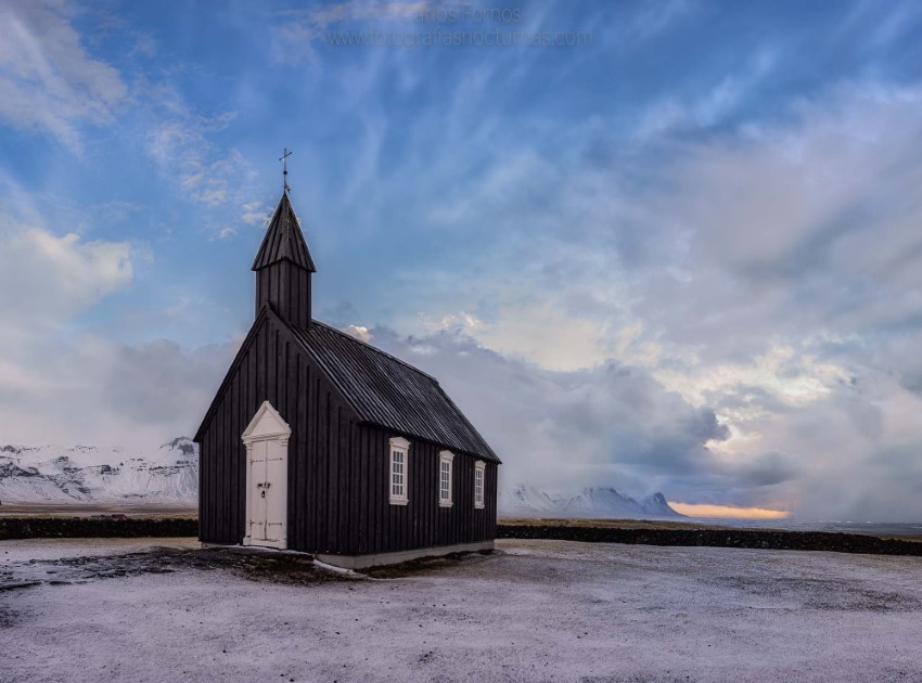
Back in time, Búðir was a prosperous fishing village and archeologic evidence shows that there have been once important trade posts. At the beginning of the 19th century, the village was abandoned and only the church remained there.
In 1701, Bent Lauridtsen got a bishop’s permit to build a church in the area. Local legends say that choosing the place to build the church was an interesting process.
An old woman came and suggested how to choose the place of the building by making a man spin until he became dazed, then let him shoot three arrows in the air. The place where the third arrow landed was the place where the church was built.
The church was erected in 1701 renovations were made much later in 1951 and then in the 1980s when the church was relocated to the place that it is today and reconstructed to its initial Danish design.
How to get there: You will find Búdakirkja in the south of Snæfellsnes peninsula where road 54 goes from the seaside to the mountains. If you follow the road to the Hotel Búdir you will find Búdakirkja near to it.
You will find another geology masterpiece near Arnarstapi Fishing Village. This tiny fishing village has picturesque coastal cliffs derived from glowing magma hitting the wild waves of the Atlantic.
Known in Iceland as the most beautiful harbour in the country. Thousands of years later erosion has formed beautiful stone arcs and a remarkable marine geyser.

Like many of the coastal villages in Iceland, Arnarstapi was also an important trade post in the past. The village had a much bigger population in the past than it has now.
Besides the fact that is a fishing village, Arnarstapi can also be found in large arctic tern colonies and also other bird species like kittiwake and fulmar.
How to get there: After you visit Búdakirkja, if you go all the way to the west you will find Arnarstapi village.
The volcanic relief in Iceland will amaze you every time with its unique formations. Inland or in water the landscape is always stunning. So is Londrangar and the hill Svalthufa.
Uniquely formed remnants of ancient basalt volcanic dikes sticking out from the sea. Londrangar and the hill Svalthufa are the remains of a crater, which has been eroded to its present form by the sea.
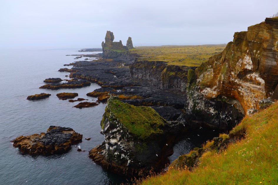
The landscape is simple but stunning. On the high cliffs, you will find puffins and fulmars nesting during the summer.
How to get there: If you drive south from the Arnarstapi, you will find Londrangar on the Útnesvegur route.
The Icelandic coastline is always surprising. It is very attractive for photographers as it combines ocean waves, black sand beaches, wildlife, volcanic formations, breathtaking sunrises and sunsets, and winter-time northern lights.
In the west part of the Snæfellsnes peninsula, you will find Djúpalónssandur. Is a beautiful pebbled beach, with a series of rocks of mysterious form emerging from the ocean. This is one of the few areas that lead down to the sea along this coast with its high dramatic cliffs.
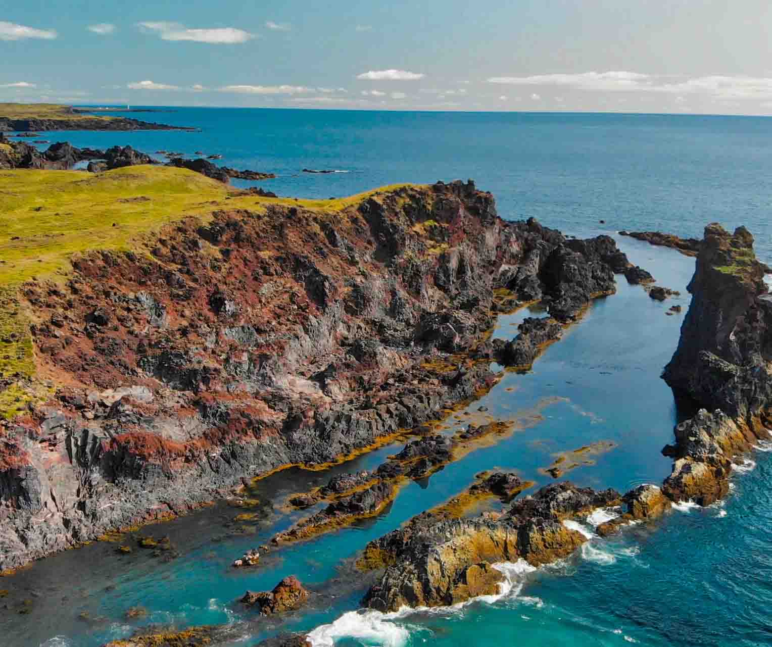
To get to the beach you have to follow the path named Nautastígur which means the Path of the Bull. The name of the path was given from the fact that there were actually bulls that were lead on this path to drink water from the lagoon.
How to get there: Driving north from Londrangar on the same route, you will find Djúpalónssandur on the left side of the road. The beach is within a short walking distance from the car parking.
As you go north in the Snæfellsnes peninsula, you will find a beautiful town named Grundarfjörður. Near the town of Grundarfjörður, you will find one of the most known landmarks in Iceland, Kirkjufell Mountain and Kirkjufellfoss.
This mountain gained popularity once the most known HBO series, Game of Thrones was released and “Arrow Mountain” appeared in some scenes of season 7. Also, many photographers tried to take a unique shot there.

At the base of the mountain, you will find a lake. This lake makes a perfect reflection of the mountain when the weather is calm.
Do not be disappointed that the mountain does not look as you expected, you may be on the wrong side. Even though, this mountain is spectacular from any angle in any season.
How to get there: Once you arrive in Grundarfjörður, you have to drive a few minutes west down the route Snaefellsnesvegur 54 to get to the base of Kirkjufell where there is also a parking space free of charge.
To find this perfect frame of the mountain and waterfall together, you have to be on the east side. But of course, there are a lot of angles from which you can photograph this mountain.
If you want to explore this area for your photography project, then it might be easier for you to book a tour of the Snæfellsnes peninsula.
Also, if you are an amateur photographer and you want to know more about photography in Iceland you can book a photography workshop where you can learn to photograph and discover Iceland at the same time.
The south coast of Iceland is probably the most famous. Along the main road, Hringvegur or Road 1 as it is known, you will find a lot of impressive places to photograph. So if you are starting from Reykjavik you have to follow Road 1 to the south coast.
After two hours of driving on Road 1, you will find one of the most beautiful waterfalls in south Iceland, Seljalandsfoss. The waterfall is close to the main road so it will be easy to find it. Near the waterfall is a parking lot where you can park your car for a small fee.
The waterfall is a part of the river Seljalandsá that has its origins underneath the glacier Eyjafjallajökull-the famous volcano that erupted in 2010 and stopped flights from all the airports in Europe. The waterfall is 60m (200 feet) high and falls from a cliff that once was the country’s coastline.
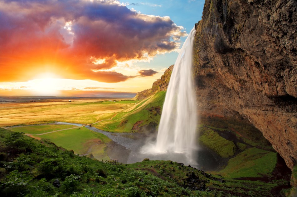
This waterfall has its beauty, especially because the cliffs behind the fall were carved through time and now there is a path that goes behind the waterfall.
Be careful during the wintertime, the path behind the waterfall is usually closed because of safety reasons. Do not adventure there as it can be really dangerous.
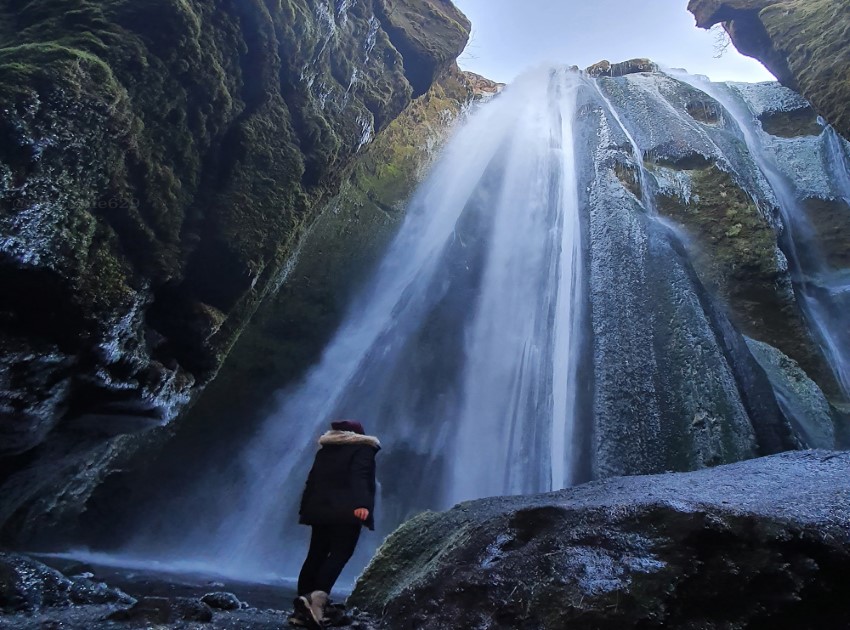
At less than a 10-minute walk north from Seljalandsfoss, there is a hidden gem inside a grot (or canyon).
Gljufrabui is a spectacular waterfall hunted by all photographers who come to Iceland. Take your waterproof equipment and clothes because you will get wet there.
Another landmark and one of the most photographed waterfalls in Iceland is Skógafoss. It is one of the biggest waterfalls in Iceland with a 25 meters’ width and a drop of 60 meters.
Due to the sunlight and the spray that water produces, there are almost rainbows that can be seen on the wall created by the water falling. As well as Seljalandsfoss, Skógafoss falls from a cliff that was once the country’s coastline.

The waterfall has its origins in the Skógá River. On this river is a large char and salmon population.
According to legend, the first Viking settler in the area buried a treasure in a cave behind the waterfall. The legend continues that locals found the chest years later but were only able to grasp the ring on the side of the chest before it disappeared again.
The ring was allegedly given to the local church. The old church door ring is now in the Skógar Museum. Believe it or not, if you got close enough to the waterfall you might be able to see the treasure chest.
You can see the Skógafoss waterfall from the top. There is a staircase that leads to the top of the waterfall which is also a belvedere platform. Also when you wander around Skógafoss respect the signs and do not get too close to the waterfall.
How to get there: Skógafoss waterfall is also visible from Route 1 so it is impossible to miss it. You also have a car park near the waterfall.
Near Skogafoss you will find another beautiful but less-known waterfall. Kvernufoss is a waterfall where you can walk behind the water so if Seljalandsfoss is too crowded you have another beautiful option.
Take your raincoat, you will get wet there. Also, the canyon that the waterfall forms is very impressive.
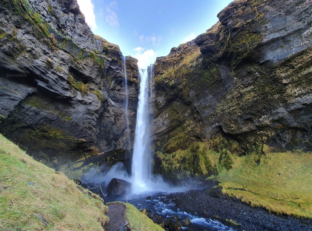
To get there you have to hike for less than 20 minutes near the Skogarsafn museum. The path to the waterfall is visible so you just have to follow it.
Also, you have to step on stiles to pass a fence just behind the Skogarsafn museum then you follow the path to Kvernufoss.
Going further on the south coast you will find the Dyrhólaey peninsula. Back in the day, Dyrhólaey was an island that joined after the Icelandic mainland. On the peninsula, there is also a historic lighthouse and a wealth of birdlife.
Dyrhólaeyjarviti is the name of the lighthouse that guards the Dyrhólaey peninsula coast and consists of a white square concrete tower. During the night you will be able to see the light flicking to the sea every 10 seconds.
The wildlife of the Dyrhólaey peninsula is represented by birdlife. You will find all-year-round species of Eider Ducks and from May to September you can find puffins.
This is the closest location from Reykjavik where you can see puffins. Sometimes the area can be closed due to the egg-laying season.
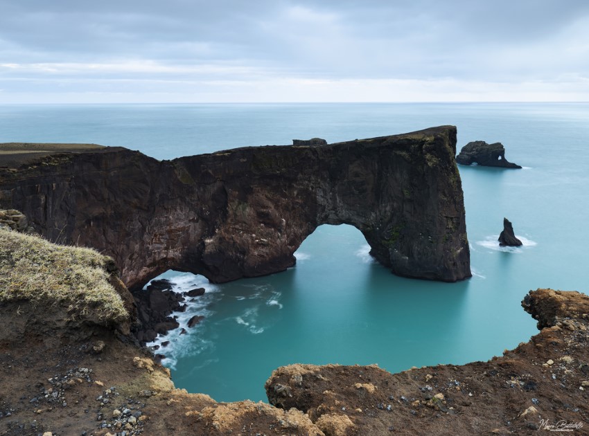
From the top of the peninsula, you will have an impressive view over the black sand beaches on both sides of the peninsula, complemented by dancing waves of the ocean. Also, you can see the creeping glacier, Mýrdalsjökull that hides the Katla volcano under its snowy cover.
How to get there: Going further on Route 1 you will see an intersection and a sign which will lead you to the car parking at the base of Dyrhólaey. From the car park, you have to hike up to the lighthouse. The path is also marked so it will be easy for you.
You can also drive up to the lighthouse, you will need a 4×4 during the winter season. The drive up can be quite tricky as the road is very narrow with tight bends so passing cars require some skills.
From the Dyrhólaey peninsula, you will see on the east side Reynisfjara Beach or Black Sand Beach as it is known worldwide.
Situated beside the fishing town of Vík í Mýrdal, Black Sand Beach is one of the most known black beaches on the south coast of Iceland. Its beauty was recognized in 1991 by National Geographic and it was voted as one of the Top 10 non-tropical beaches on Earth.
Its enormous basalt columns and ocean waves roaring on the beach attract thousands of tourists every year and also is a must-see for photographers.
You will observe some rocky formations shaped in time by the ocean waves. Reynisdrangar is the name of those formations that are sitting on the shoreline.
There are some legends about those formations and the basalt columns. In local folklore, these large basalt columns were once trolls who were trying to pull the ships from the ocean to the shore.
Once they went out too late in the night and when the sun started to rise the trolls turned into solid rocks.
About Reynisdrangar, it is believed in the local folklore that a man`s wife was kidnapped and killed by two trolls. Then the man followed the trolls down to the Reynisfjara where he froze them so they could never kill again.
You will see that many locations in Iceland were used in filming scenes of the HBO series Game of Thrones. Also, you will recognize Reynisdrangar from season 7 of the series in the scene “Eastwatch-by-the-Sea”.
Being close to the Dyrhólaey peninsula, on Reynisfjara you will also see some species of birds like puffins, fulmars, and guillemots which are usually nesting there.
If you want to explore the South Coast of Iceland, you can book a tour or for your photography project, you can book a photography workshop.
Following Route 1 to the southeast, you will get into the Vatnajökull National Park. There you will find Svartifoss.
Svartifoss, in translation Black Waterfall, has its charm. The waterfall flows through basalt columns and it is 20 meters high. The location is not easily accessible and you have to hike to get to it.

How to get there: After driving through the lava sand plains of Skeiðarársandur glacial outwash, you have to hike from the visitor centre about 1.5 km.
You will find the waterfall after you come across other small waterfalls in the gorge. You can approach close to the waterfall but do not pass the safe area.
Jökulsárlón Glacier Lagoon is a must-see in Iceland. It is beautiful beyond description. When you think nothing can beat the scenery, the Jokulsarlon glacier lagoon opens up before your eyes and takes your breath away.
Packed with icebergs in various shades of white and blue, the lagoon‘s extraordinary scenery is popular with travellers, photographers, and filmmakers from all over the world.
Various bird species can be seen feeding in and around the lagoon and seals are a fairly common sight both at the mouth of the lagoon and at the seaside beach.
During the summer, there are options for the Amphibian Boat Tour and Zodiac Tour that can bring you into the lagoon and get some up-close encounters with the icebergs.
During the winter, you can go on a Blue Ice Cave Exploration to Breiðamerkurjökull, the glacier tongue that feeds Jökulsárlón.
How to get there: Glacier Lagoon is visible from Route 1. As you follow the route from the south to the east you will find Jökulsárlón Glacier Lagoon on the left side and Diamond Beach on the right side.
Diamond Beach is a true jewel of Iceland. Known locally as Breiðamerkursandur, it’s a must-see and photograph place. Ice pieces come off from the Breidamerkurjokull Glacier and float into the lagoon.
All ice blocks from Glacier Lagoon are driven by the ocean currents which get into the lagoon back into the ocean and then pushed to the black beach creating a stark contrast with the sand.
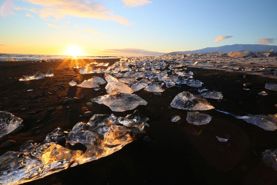
Also, wildlife enthusiasts can see seals resting on the beach for certain periods and is the best place in Iceland to see orcas from the shore.
Driving to the east from Diamond Beach, near the town of Höfn there is a place that inspired me to write this blog and is recognized by many photographers as being a paradise for photography.
Stokksnes is in my opinion the most beautiful black beach in Iceland. Guarded by Vestrahorn mountains and being washed by ocean waves, this place has great photographic potential.
Under the northern lights the midnight sun, or the cold snow or under colourful winter sunsets this place will amaze you any time of the year. You have to go there if you come to Iceland.

How to get there: On Route 1 to east Iceland you will see the indicator to the beach on the right side of the road. The beach is private propriety so you have to pay a small entrance fee.
If you want to travel on your own to those places you can book a self-drive tour or for your photography project, you can book a photography workshop. Also, you can find a lot of private photography tours you may be interested in.


