The Highlights of South Iceland
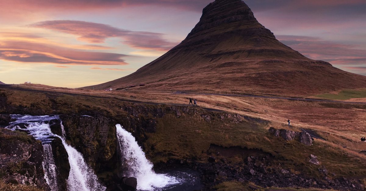
The South Coast of Iceland is the most visited part of the country. You will see something that will delight your eyes and visit some world wonders at every step.
Many majestic waterfalls, iconic black sand beaches, massive glaciers, breathtaking landscapes and many hidden gems that you don’t even think about await you in Iceland.
I put together a mini-guide with all the gems you have to see on the Icelandic south coast. You can access the link below to get the exact locations of all treasures on the South Coast.
The Golden Circle route is the most famous touristy route in Iceland. It covers around 300 km to three of the most visited places in Iceland, the Geysir area, Gullfoss waterfall and Þingvellir National Park.
There are many Golden Circle tours, and people enjoy visiting the famous route and doing different activities in the area.
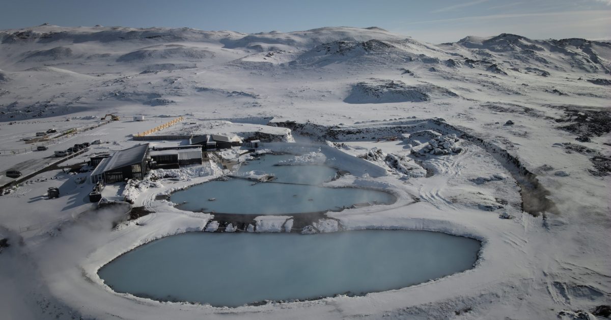
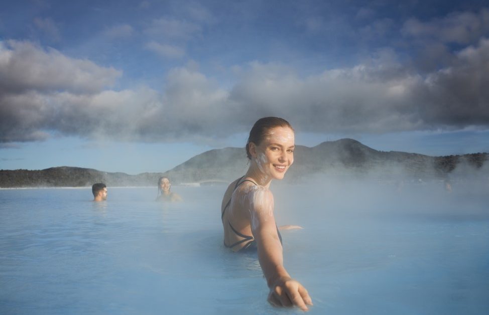
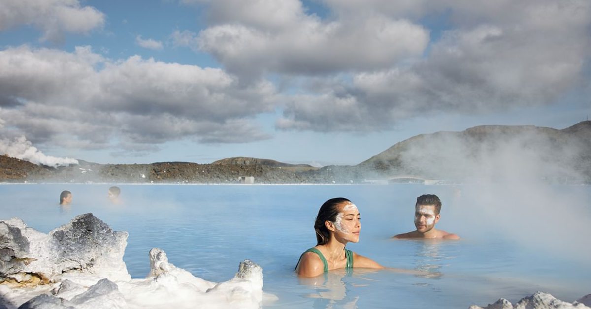
You can see not only the landmarks of the Golden Circle route, but you can enjoy a geothermal bath, a visit to a farm or even snorkelling.
Þingvellir National Park – The heart of Iceland
Þingvellir is the heart of Iceland for many reasons. But the most important one is that Þingvellir was the place of one of the first parliaments in Europe.
The Alþing general assembly was established around 930, and Icelanders discussed all the significant events in Iceland’s history at Þingvellir until 1798.
Þingvellir is nowadays a national park, and according to the Icelandic law established in 1928, the entire area must always be the property of the Icelandic nation to preserve the Alþing.
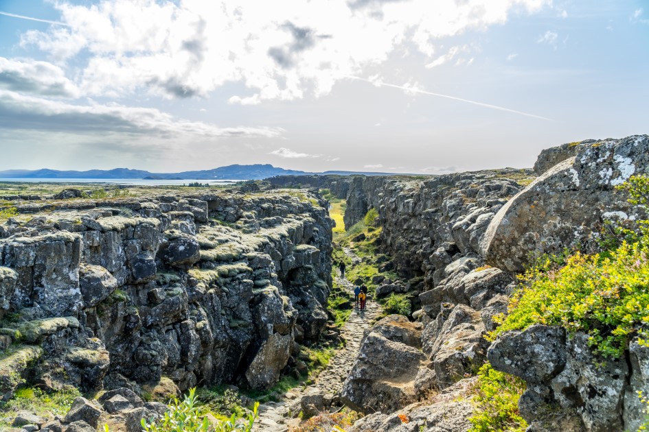
The first settlement in Iceland is also related to Þingvellir. Around 800 AD, the Viking period started in Iceland when, after internal disputes in Norway, people there decided to take their belongings and travel over the sea to Iceland.
Starting with the arrival of Ingólfur Arnarson in Iceland in 874, the next 56 years after this moment were considered ‘The settlement period” of Iceland.
In Íslendingabók is mentioned that Ingólfur Arnarson reached the Icelandic mainland for the first time in Reykjavik in 870 AD, and many others followed him.
The people that lived in the new land were formed by different groups with different beliefs. Those differences and the limited natural resources people found in the new country led to violence between people. Once the population increased in Iceland, there was a need for laws.
After the settlements were established, the first two district assemblies were formed, one in Þórsnes, near Stykkishólmur, and the other in Kjalarnes. Later, many other congregations were installed across the country.
With all those district assemblies, the power in Iceland was in the hands of the descendants of Ingólfur settled in the area of Reykjavik. This created the need to have one general assembly with representatives from all the district assemblies across the country.
At the beginning of 830 AD, chieftains in Iceland agreed to send someone back to Norway to learn the laws and how people are organised there and bring those laws and customs to Iceland.
The man sent to Norway for this was Úlfljótur, and the first law made by the Alþing has his name – Úlfljót’s Law. After returning from Norway, his foster brother, Grímur geitskór, travelled around Iceland to the other assemblies to find support and a good place for forming a general assembly of Iceland.
They decided on the first meeting of the Alþing at Bláskógar, now the place where is Þingvellir. This first meeting of the Alþing has marked the beginning of the Icelandic nation.
The land where Þingvellir was owned at that time by Þórir Kroppinskeggur. But because he had murdered a servant, he was punished, and all his land was given to the newly formed Alþing.
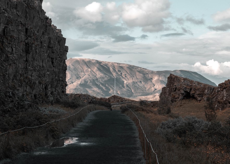
The relief of the area at Þingvellir was perfect for organising the meetings of the Alþing, and people decided to reunite there to discuss the problems of the nation.
They did not have only one person to make all the decisions, but they all agreed on what they discussed there; everything was democratic.
Þingvellir translates as ‘the fields of parliament’, and all the significant events in the history of Iceland were discussed and decided there. They even agreed on the transition from the Asatru, the Old Norse pagan belief system, to Christianity in 1000 AD when the Norwegian invasion threatened them.
In 1944 AD, at Þingvellir, the Alþing declared the independence of the Icelandic nation from Denmark and, at the same time, confirmed their first President.
The Alþing is still existing today, but it was relocated to Reykjavik after the Danish colonialism. The Alþing constantly functioned even through the Icelandic Civil War and the only period when the Alþing stopped the meetings was during the Danish colonialism between 1799 and 1844. The Icelandic Parliament is the longest-running parliament in the world that still exists.
You can find a more detailed history of Þingvellir and the first parliament in Iceland on the official website of the Þingvellir National Park.
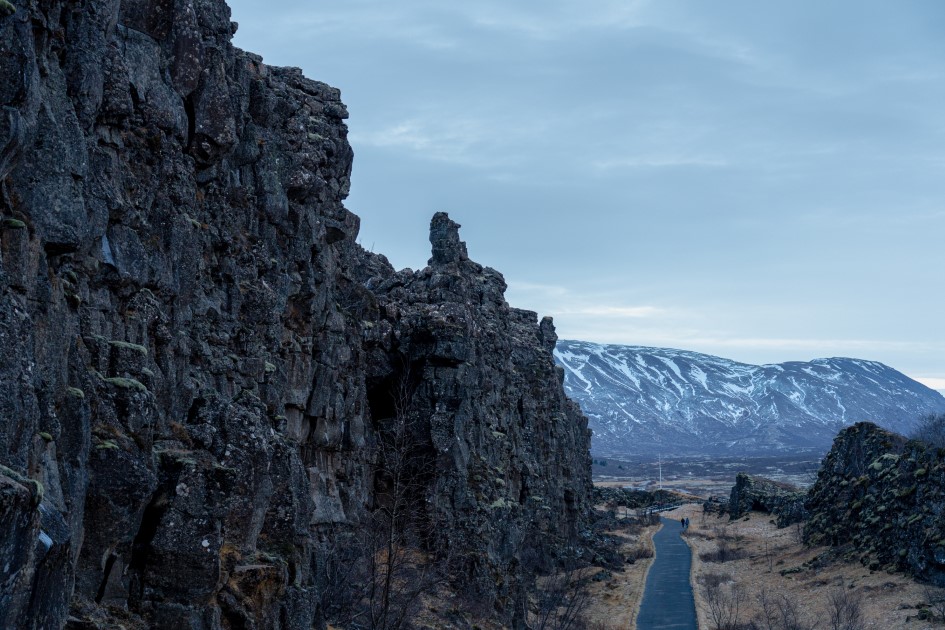
The site’s history at Þingvellir contributed to the decision to make the area a National Park in 1930, precisely a millennium after the first meeting of the Alþingi. Also, in 2004, Þingvellir National Park became a part of the UNESCO World Heritage.
Þingvellir National Park is not only an important place historically speaking, but its geology is also unique in the world. Þingvellir is located on the Mid-Atlantic Rift, and it is the only place where the Rift is above the water level.
The rift between the American and Eurasian plates is visible at Þingvellir. You can walk in the rift valley and see the walls of the tectonic plates.
The tectonic plates are moving at 2,5 cm a year, which is visible within the park. Þingvellir is a volcanic area that is currently inactive, but there is a chance for some eruptions to happen. Many earthquakes are happening every day, more or less intense.
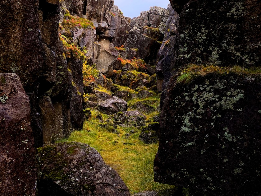
Its significance and location within only a 45-minute drive from Reykjavik make Þingvellir National Park the most visited place in Iceland. It is also the most important landmark on the famous Golden Circle route.
The site’s uniqueness at Þingvellir National Park amazed the production team of the Game of Thrones, and they filmed there some scenes for season 5 of the famous series.
The National Park can be seen as the narrow path leading to the Eyrie when Littlefinger and Sansa Stark arrive at the Eyrie and when Catelyn Stark comes at her sister.
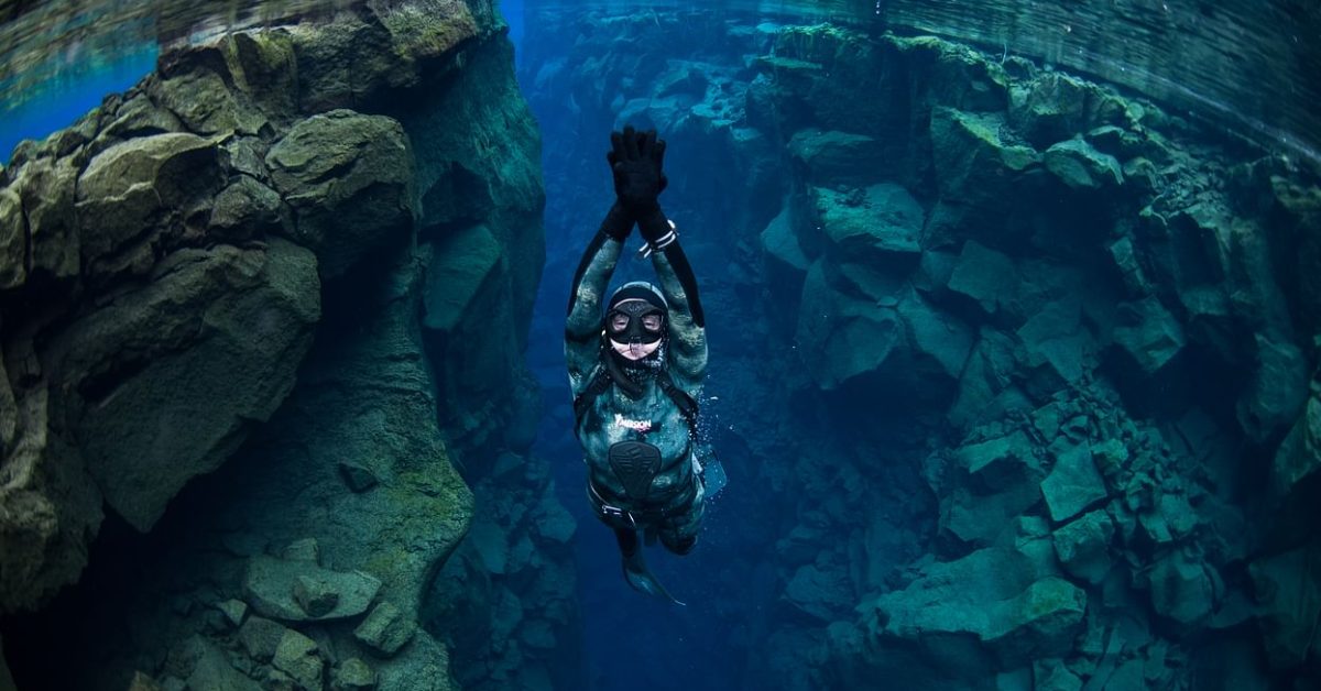
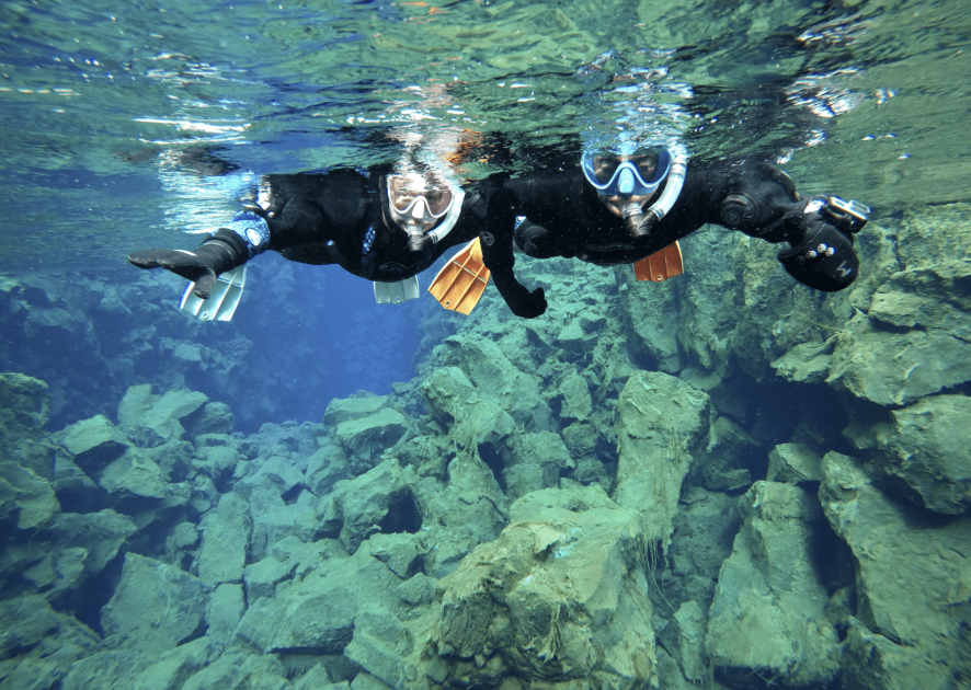
Another thing Þingvellir National Park is famous for around the world is that there is a place where you can go snorkelling between the tectonic plates. Silfra is that place, and it is unique. To go diving there, you have to meet some requirements.
Read more about this on our blog about Snorkelling at Silfra.
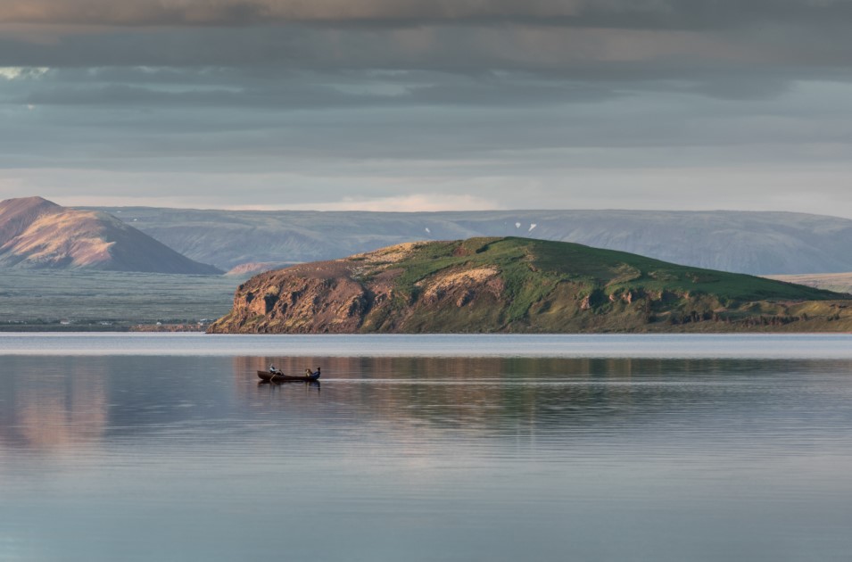
There is also a lake at Þingvellir National Park called Þingvellirvatn, and people can enjoy the fauna around it. From the lake, people can fish trout, and around the lake, many birds can be spotted, such as many species of duck, golden plovers and snipes.
There are also Arctic Foxes and Minks in the National Park, so wildlife enthusiasts will have many things to see there.
Þingvellir National Park is an important place for the Icelandic community, so respecting the environment there is very important for them. If you plan to visit Þingvellir, please remember that the flora and fauna there are very sensitive.
Do not step on the moss; the moss covering the rocks is very sensitive and takes years to recover.
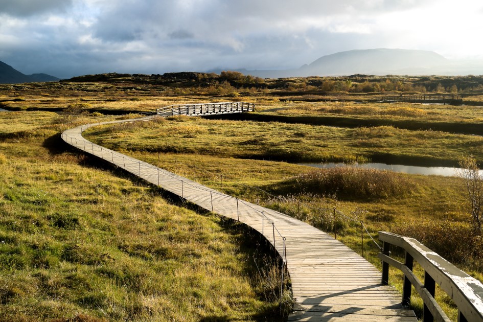
The paths within Þingvellir National Park are marked, and it is recommended to follow them. Icelanders are very protective of nature in their country, and it is a sign of respect to do the same once you are in Iceland.
Visit Þingvellir National Park on a Golden Circle Tour and share with us your experience.
Geysir area
The famous Geysir is on everyone’s lips when talking about what you want to see in Iceland. It is included in many travel packages and visited by almost all tourists who come for the first time.
The term ‘geyser’ used worldwide comes from Icelandic and the actual Geysir.
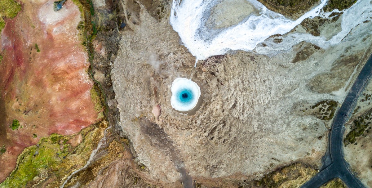
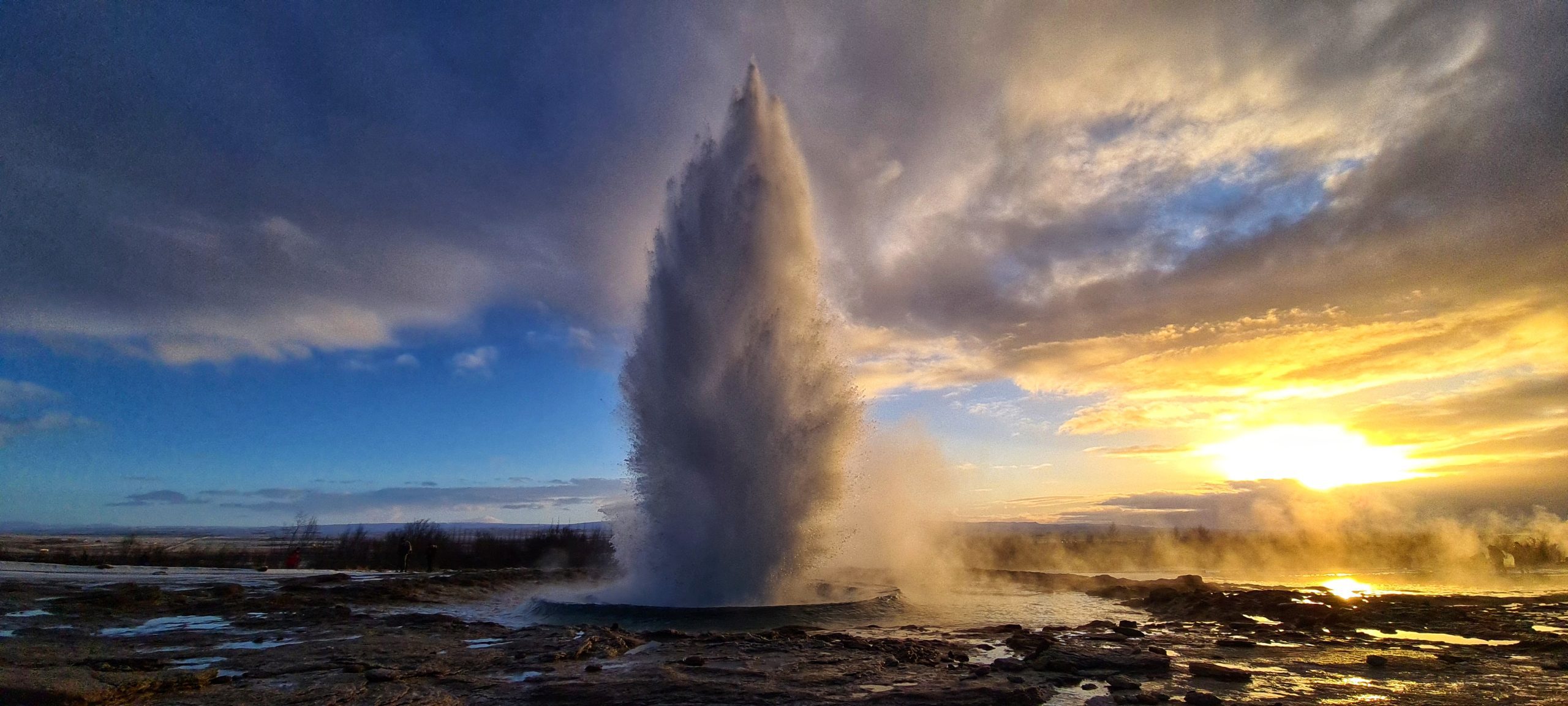
Geysir is a geothermal area part of Iceland’s most famous touristy route, the Golden Circle. In Haukadalur Valley, there are some hot springs and geysers, Smiður, Litli-Strokkur and the famous Strokkur.
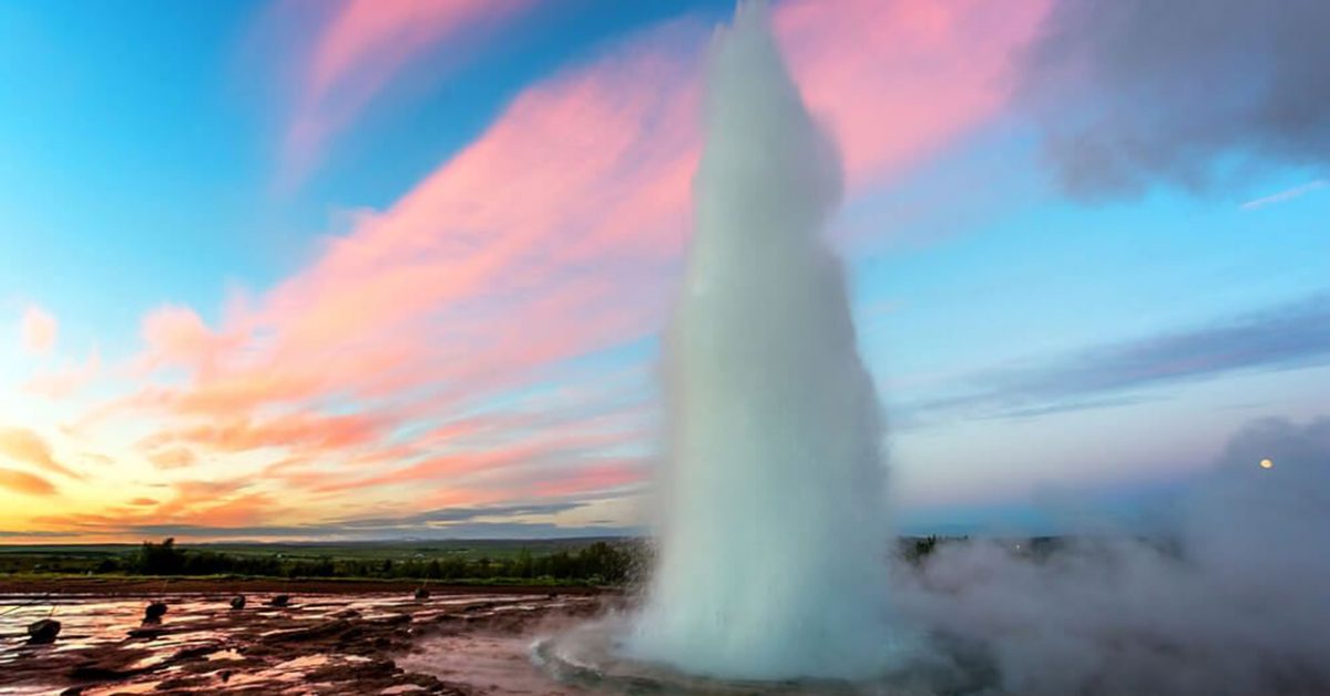
Every five to ten minutes, Strokkur erupts and shoots jets of boiling water to a height between 20 to 40 meters (65 to 130 feet). It is the most famous and the most Instagrammable one.
The Geysir is larger than the three geysers mentioned and currently is inactive. It is believed that Geysir was created during an earthquake followed by the devastating eruption of Mt Hekla.
Back in time, it erupted regularly once every three hours, and then the explosions progressively took much longer intervals until they stopped altogether.
The Geysir was active until 1916, then had an episode of an outbreak in 1935. Its opening is 18 meters wide, and it has a depth of about 20 meters.
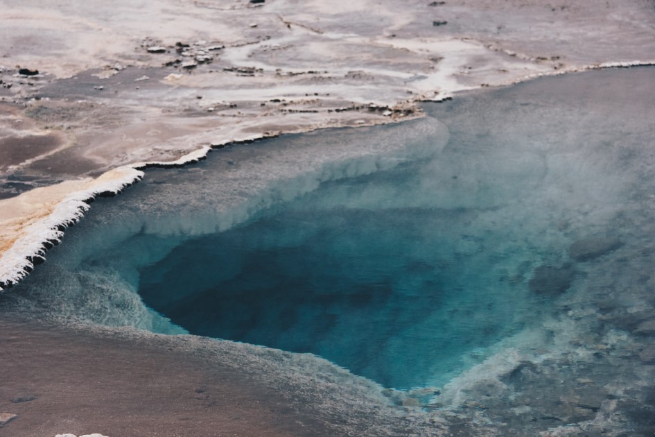
It is believed that the Geysir stopped shooting columns of hot water in the air because of the accumulations of different materials that tourists were throwing into the geyser. But there are, of course, other reasons for its cessation.
The area of Grater Geysir also has hot springs and mud pots with unusual colours hissing steam vents, hot and cold springs, warm streams, and primitive plants. You can see more than the geysers.
The Golden Waterfall of Iceland
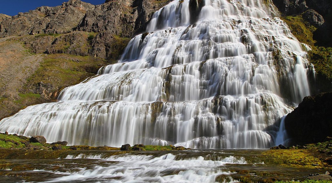
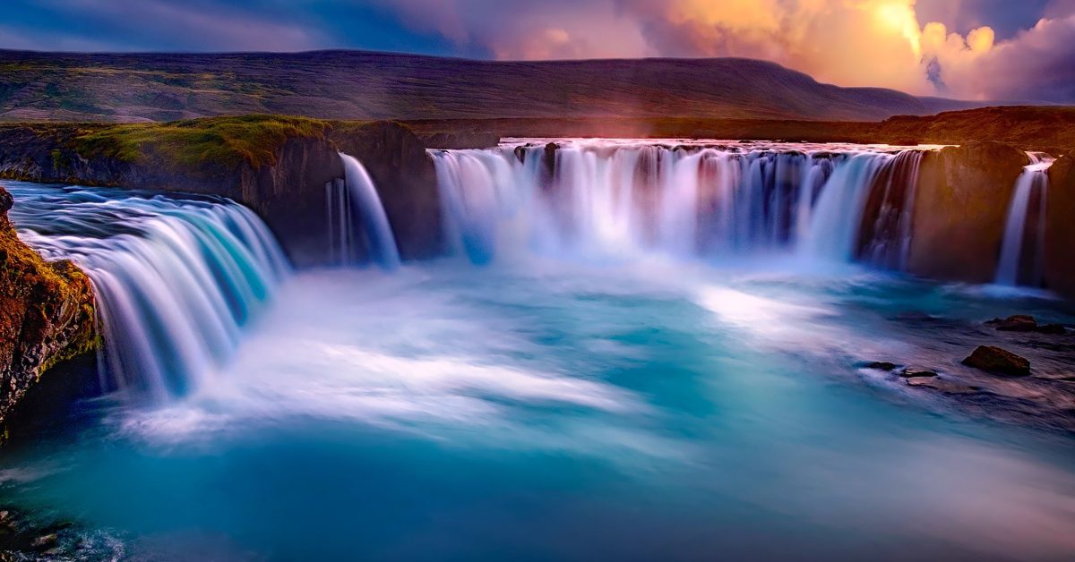
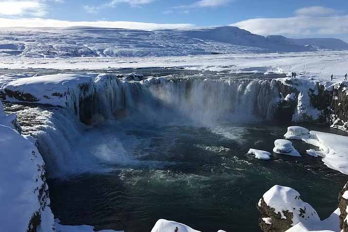
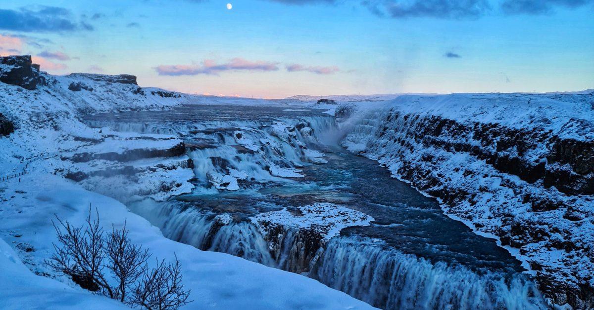
Gullfoss waterfall is one of the most popular waterfalls in Iceland mostly because of its location in the Southwest of Iceland on the Golden Circle route, a famous sightseeing route that many tourists choose to follow when they come to Iceland.
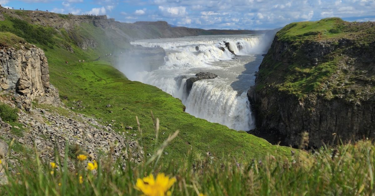
The waterfall is enormous. It was formed by floodwaters that forced their way through basalt lava columns and it has two falls, the smaller one is 11 meters (36 feet), and the second and the bigger one is 21 meters (69 feet). The water flow is different depending on the seasons.
Therefore, during the summer the water flow is about 140 cubic meters (459 cubic feet) every second and during the winter the water flow drops to about 109 cubic meters (358 cubic feet) every second.
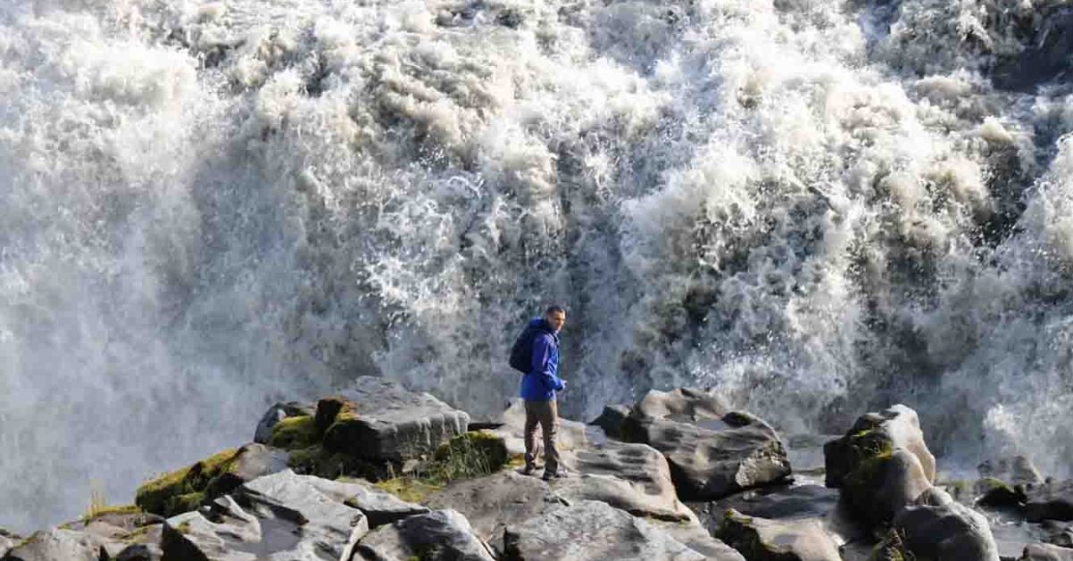
Knowing this, you will not be surprised by the power of this waterfall and the water spray, of which you will need a rain jacket if you get too close.

Before flowing into the Hvítá River canyon, the Gullfoss waterfall is fed by the river with the same name as the canyon. Both walls of this canyon reach up to 70 meters in height (230 feet). Then the waterfall descends into the great Gullfossgjúfur canyon.
The origin of the Gullfoss waterfall name has three stories: one says that the waterfall has its name from the golden hue that shines in its glacial waters under the sun.
The other story says that the name of the waterfall was given because of the rainbow that forms due to the water spray of the waterfall.
The third story of the waterfall’s name says that the name Gullfoss was found in a travel journal belonging to Sveinn Pálsson. According to gullfoss.is, in the travel journal was written that: “Once upon a time, a farmer named Gýgur lived at Gýgjarhóll.
He had plenty of gold and could not bear the thought of someone else possessing it after his lifetime. To prevent this, he placed the gold in a coffer and threw it into the waterfall.”
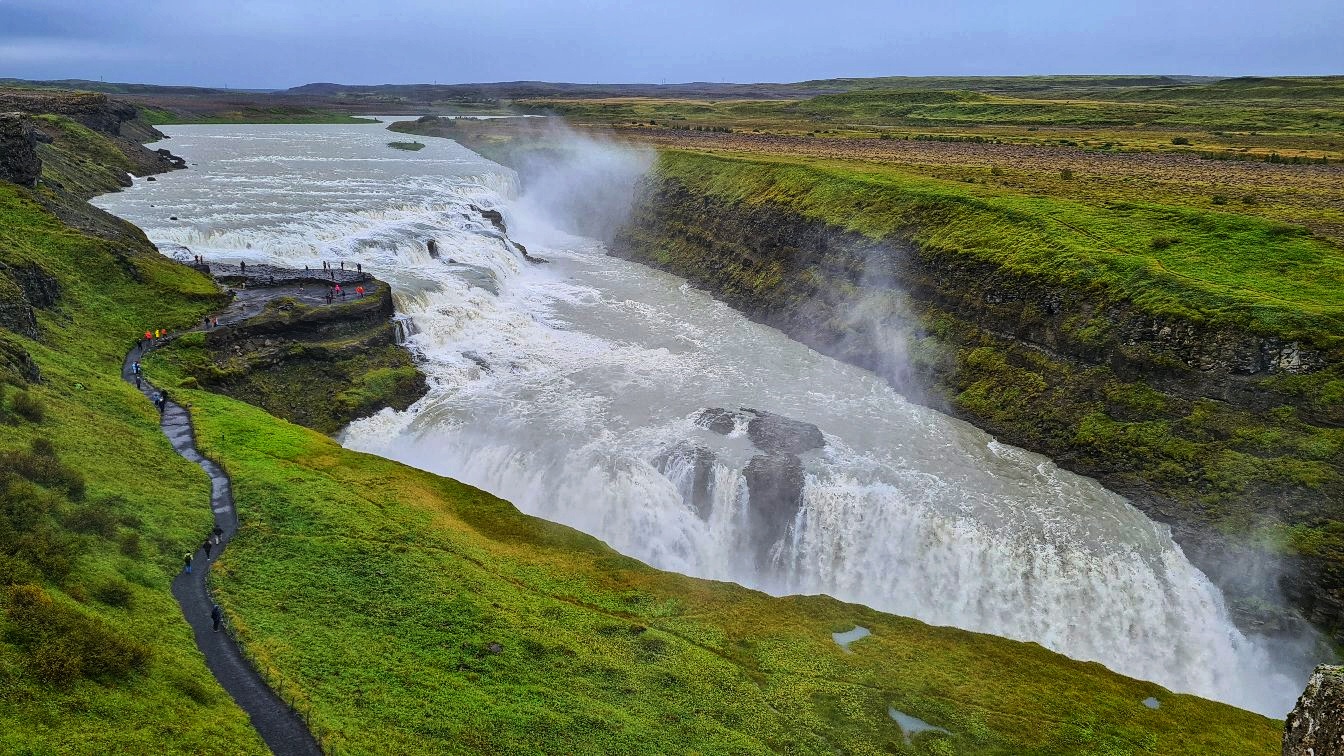
The history of the Gullfoss waterfall is very interesting. There is a story about a girl named Sigríður Tómasdóttir is considered to be the protector of the Gullfoss Waterfall. “She was born 24th of February 1871 and she died in the Autumn of 1957, aged 87.
She lived all her life in Brattholt, a farm that still exists today, and was the second eldest of 13 children born from Margrét Pórðardóttir, a housewife and Tómas Tómasson, a farmer on that same farm.” Gullfoss.is
Tourism around the Gullfoss waterfall started as far back as 1875 but access to it was difficult. Sigríður and her sisters often guided the tourists to the waterfall and also built the first trail to the waterfall.
At that time the waterfall was owned by Tómas Tómasson, Sigríður’s father. The waterfall became famous and because of its power, some foreign investors wanted to buy the land and use the waterfall as a power generator.
When Sigríður found out about this, she took the investors to the court and she fought to protect the waterfall, even threatening to throw herself in the river. She was helped in the court by a lawyer who later became the first president of an independent Iceland in 1944.
Their fight in the court against the investors had success and the investors gave up on their plan of buying the land and using the waterfall as a power generator.
After her efforts to protect the waterfall, Sigríður Tómasdóttir is one of the most famous figures in Iceland’s history. At the top of the Gullfoss waterfall, there is also a stone with a plaque detailing Sigríður’s story.
Gullfoss waterfall is visited on every Golden Circle tour. To get there you have to drive east from Reykjavik for about one hour and a half.
You can visit the waterfall every day from 9:30 to 18:30.
There are many hotels in the area of the Golden Circle where you can stay overnight and many activities to do from there.
Some of those activities include enjoying a geothermal bath, snorkelling, snowmobile riding, farm visits and enjoying the local cuisine.
Do not miss the Golden Circle route when you come to Iceland.
Walking behind Seljalandsfoss
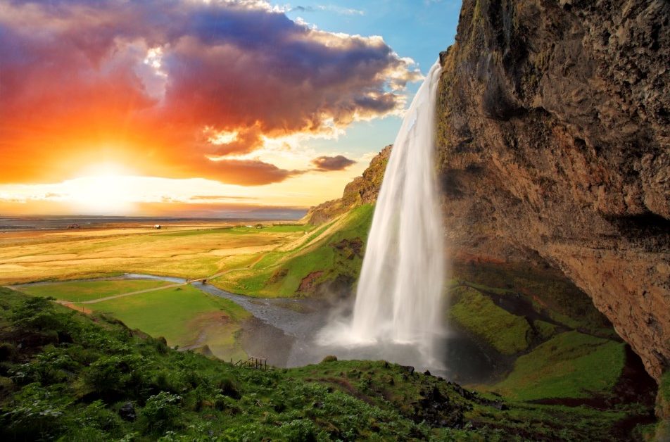
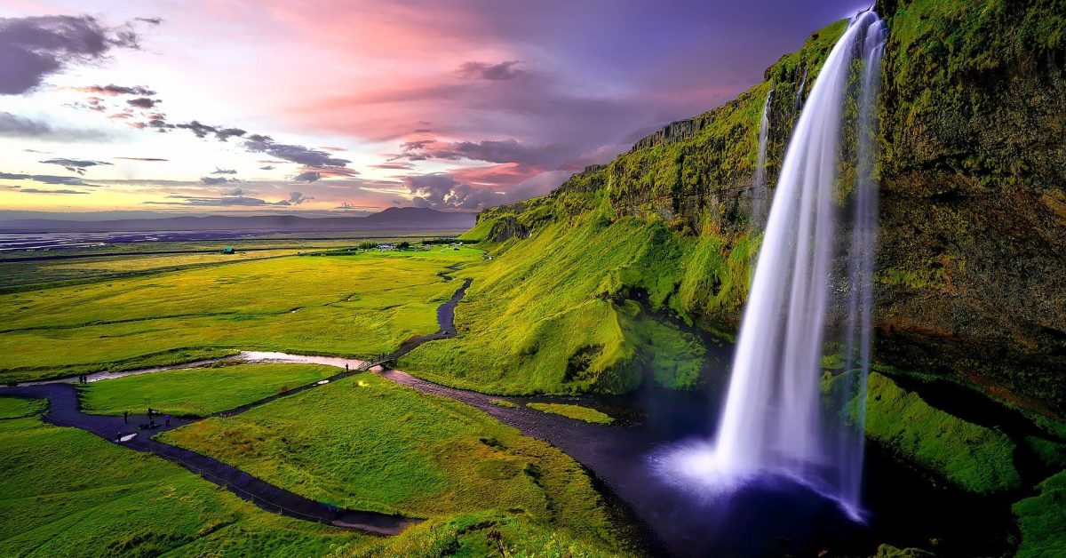
Seljalandsfoss is one of the most beautiful waterfalls in South Iceland
After two hours of driving from Reykjavik on Route 1, you will find one of the most beautiful waterfalls in south Iceland, Seljalandsfoss.
The waterfall is close to the main road so it will be easy to find it. Near the waterfall is a parking lot where you can park your car for a small fee. Be careful during the wintertime, the path behind the waterfall is usually closed because of safety reasons.
Do not adventure there as it can be really dangerous.
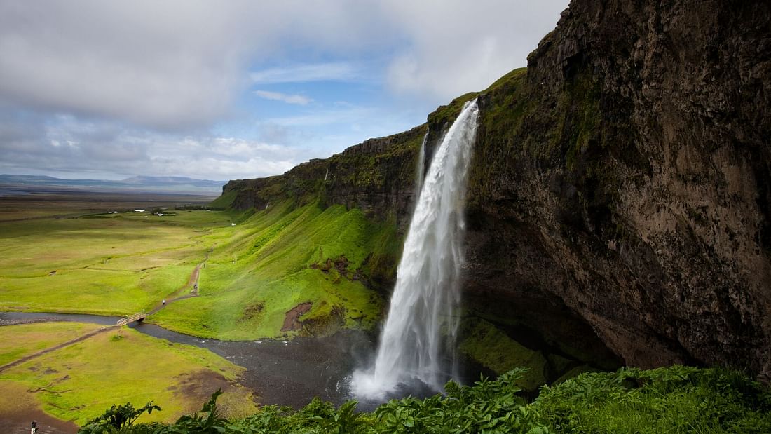
The waterfall is a part of the river Seljalandsá that has its origins underneath the glacier Eyjafjallajökull-the famous volcano that erupted in 2010 and blocked the airports in Europe. The waterfall is 60 m (200 feet) high and falls from a cliff that once was the country’s coastline.
This waterfall has its beauty especially because the cliffs behind the fall were carved through time and now there is a path that goes behind the waterfall.
Gljufrabui – a hidden gem
Another hidden gem in South Iceland is Gljufrabui. Situated just 10 minutes walking from Seljalandsfoss, Gljufrabui is less known because of its location in a gorge that hides the waterfall inside. Fed by the meltwater of the glacier Eyjafjallajökull, Gljufrabui has a 40-meter fall.
Although is not a popular waterfall, Gljufrabui is hunted by all photographers who come to Iceland. Take your waterproof equipment and clothes if you want to go because you will get wet there.
The black lava walls of the gorge covered by moos, the open sky above the gorge, and the water mist create an ideal picture that will impress you. You cannot leave without taking photos there.
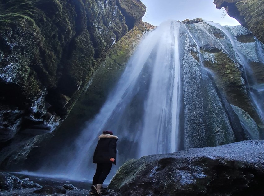
To find Gljufrabui you have to walk 10 mins north from Seljalandsfoss. You will see a small open space and the water from Gljufrabui running outside the gorge.
To get inside the gorge you will have to walk through the water but trust me it will be worth getting your shoes and clothes wet. Although, I recommend waterproof clothes and shoes.
Be careful if you go there during wintertime, everything is frozen and it can be dangerous if you slip on the ice. Trust me! Been there and done that and it wasn’t fun.
Vestmannaeyjar archipelago
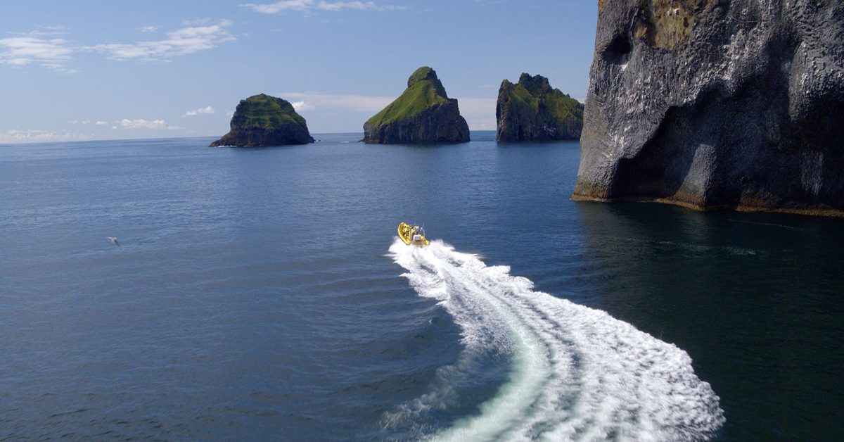
You probably have seen on the internet photos of the “Elephant Rock” and also photos of an island that has only a building on it. Those are some of the most popular photos from Iceland that you will see online, but where were they taken? Westman Islands!
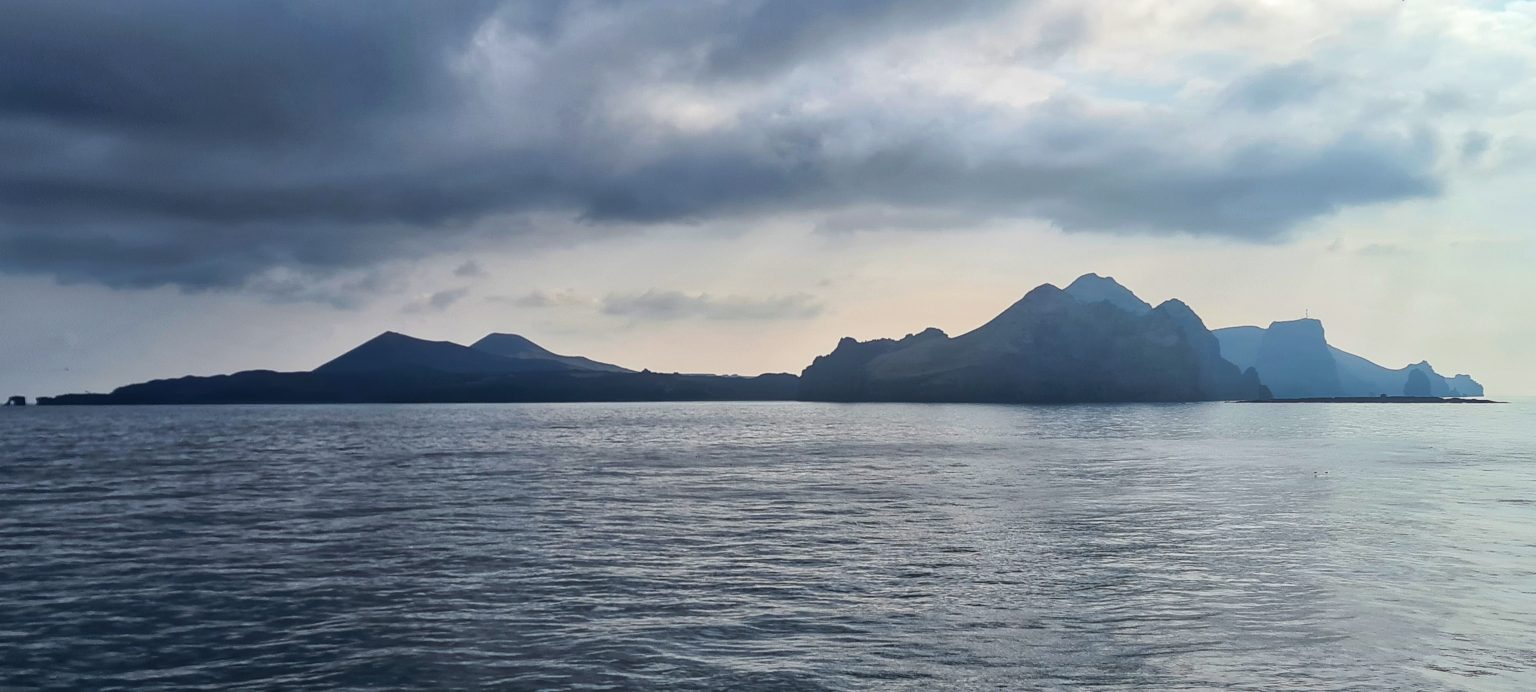
Located in the South of Iceland, Vestmannaeyjar is an archipelago that has 15 islands and 30 rock stacks around them. Is one of the most interesting places in Iceland as it has a rich and not-so-happy history and rich geology also.
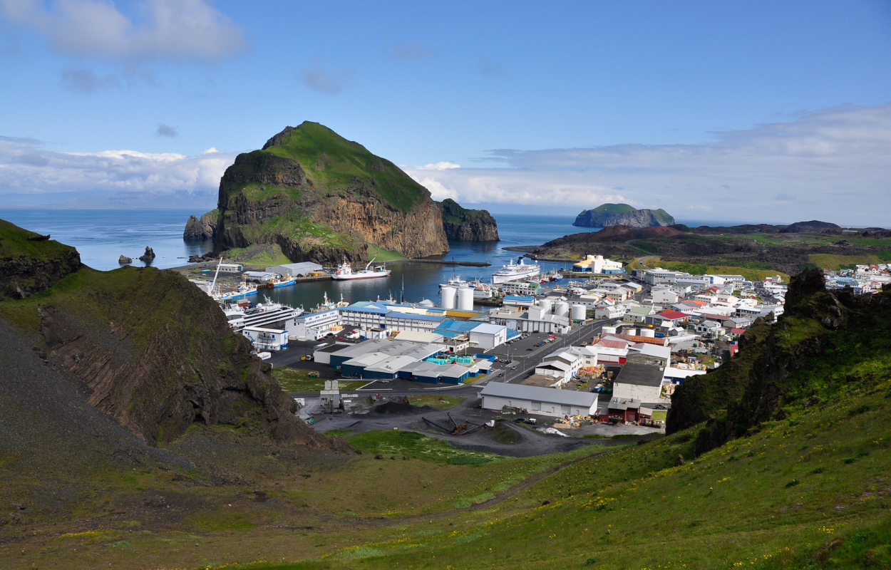
The history of the Westman Islands begins after Iceland was settled for the first time by Ingólfr Arnarson who came to the island with his wife and their slaves. A few years later his half-brother, joined him.
Shortly after that, Ingólfr Arnarson was killed by two of his slaves. His half-brother wanted revenge on Ingólfr’s death and wanted to find the slaves and kill them. The slaves went to the Westman Islands to hide from the fear of the vengeful brother.
The slaves were caught and killed on the Westman Islands and since then the islands have taken their name. The slaves were Irish and were called Westmen because, at that time, Ireland was considered to be the westernmost landmass before Iceland was discovered.
Further on, the history of the islands continued to be dark. The largest island in the archipelago is Heymaey and some people have lived there since an early era. They used natural resources such as the ocean, puffins and bird’s eggs to live there.
In 1627 Barbary Pirates from Algiers took control over the island. They stayed there for three days and took back home with them 237 slaves. The majority of people who were taken as slaves lived their lives in bondage.
Another black chapter in the history of Vestmannaeyjar was in 1974. The Islands were in a modern stage, the connection with the mainland was stronger and easier.
On the 20th of January at 1:55 am a fissure opened right in the middle of the Heymaey town, and the Eldfell volcano started to erupt violently.
No one was killed during this event as the people were prepared for such unfortunate events. The lucky thing was that a day before, a strong storm kept all the ships docked in the harbours so when the volcano started to erupt, everyone on the island was saved by being transported to the mainland with the ships.
The whole town was covered with lava and volcanic ash. 3500 houses were destroyed and the Icelandic authorities were desperate to help the inhabitants as much as they could.
At that time, there was a US-NATO base in Iceland and they helped the authorities face the force of nature.
They used a new technique that proved to be effective in protecting the harbour. They pumped the seawater on the lava flows to cool it down and to change its direction.
In this way, they managed to protect the harbour and after the eruption ended people repopulated the island.
Now they use their history to attract people and Vestmannaeyjar was one of the most visited places in Iceland until the pandemic happened.
There is a museum where you can see pictures and learn about the eruption that happened in 1974 and also you can see the crater of the volcano.
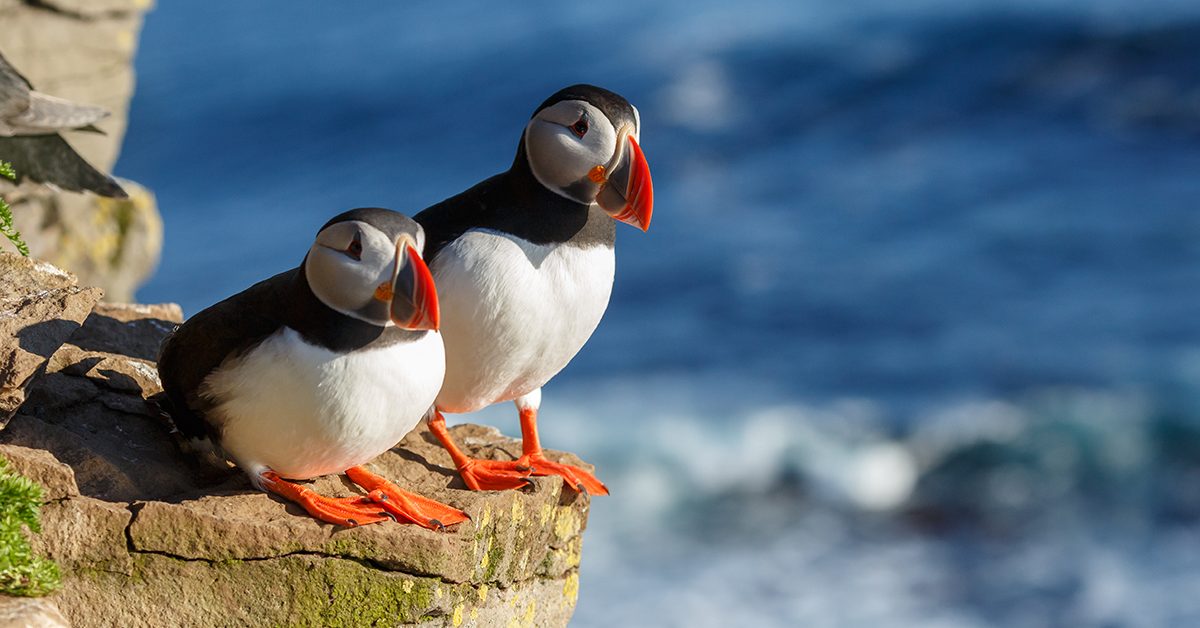
Vestmannaeyjar has many experiences to offer. It is the place with the largest population of Atlantic Puffins. Although, puffins are coming later there than in the rest of the country.
During August, when puffins are leaving there is an interesting phenomenon that you might experience there. Puffins are guided by the light of the moon to fly from the islands to the ocean, but because of the lights in Heymaey town, they get distracted and end up in the streets.
Every year, kids take the puffins found on the streets and take them to the vet to be checked before getting released on the cliffs. If you are lucky, you can participate in this action too, but keep in mind that nothing is guaranteed. Many other species of birds are nesting on Westman islands.
When it comes to wildlife, the Westman Islands are offering also the chance to see whales. There is also a Beluga Whale sanctuary which is the first of this kind in the world.
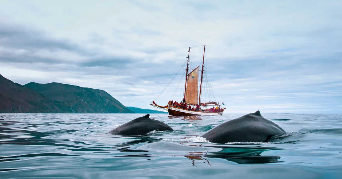
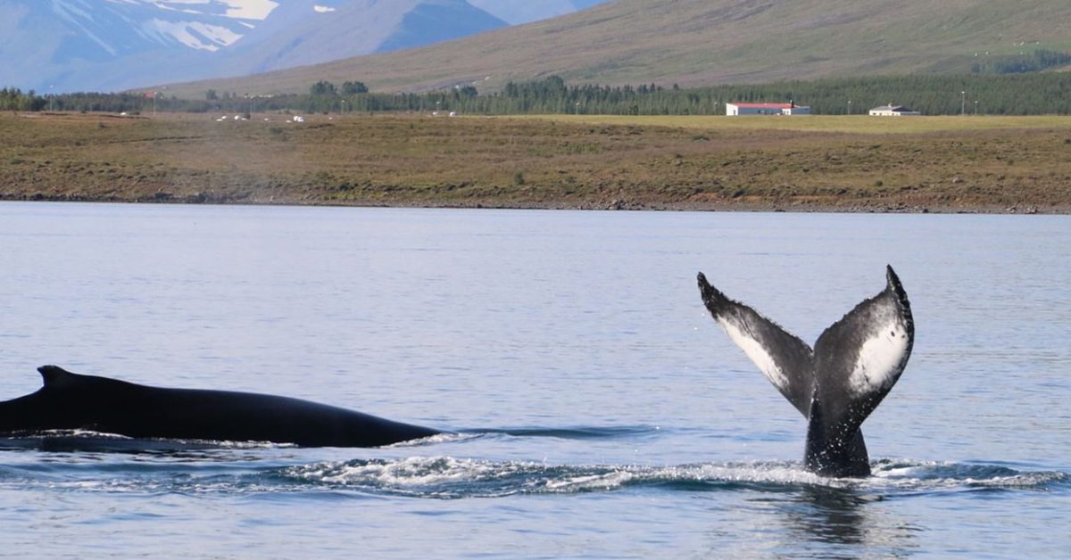
On the boat tours that are organized around the islands, you can see also the summer Fin, Minke, and Humpback Whales and Orcas throughout the year. Also, on the boat tours, people are interested in seeing and taking pictures of the “Elephant” rock.
To get to Westman Island there are two options: to take the ferry or to fly from Reykjavik domestic airport. The ferry may be the easiest way as you can go to the ferry harbour if you are around the area.
Before the pandemic, the tickets for the ferry were booked in advance and the ferry was always fully booked. You can take your car on the ferry also, but you have to book in advance as there are limited numbers of cars that can be taken on the ferry.
Of course, you can go there without a car, the island is small and can be discovered on foot if you are lucky and the weather is beautiful. If the weather is bad you may need a car.
Also, if you are on the Heymaey island and the weather is bad, the price for the ferry is changing and you may be sent to another harbour to take the ferry.
The island is very visited during the summertime as then the weather is beautiful and less changeable during the day. Check the website for ferry prices, visitwestmanislands.com.
Skógafoss-the majestic waterfall in South Iceland
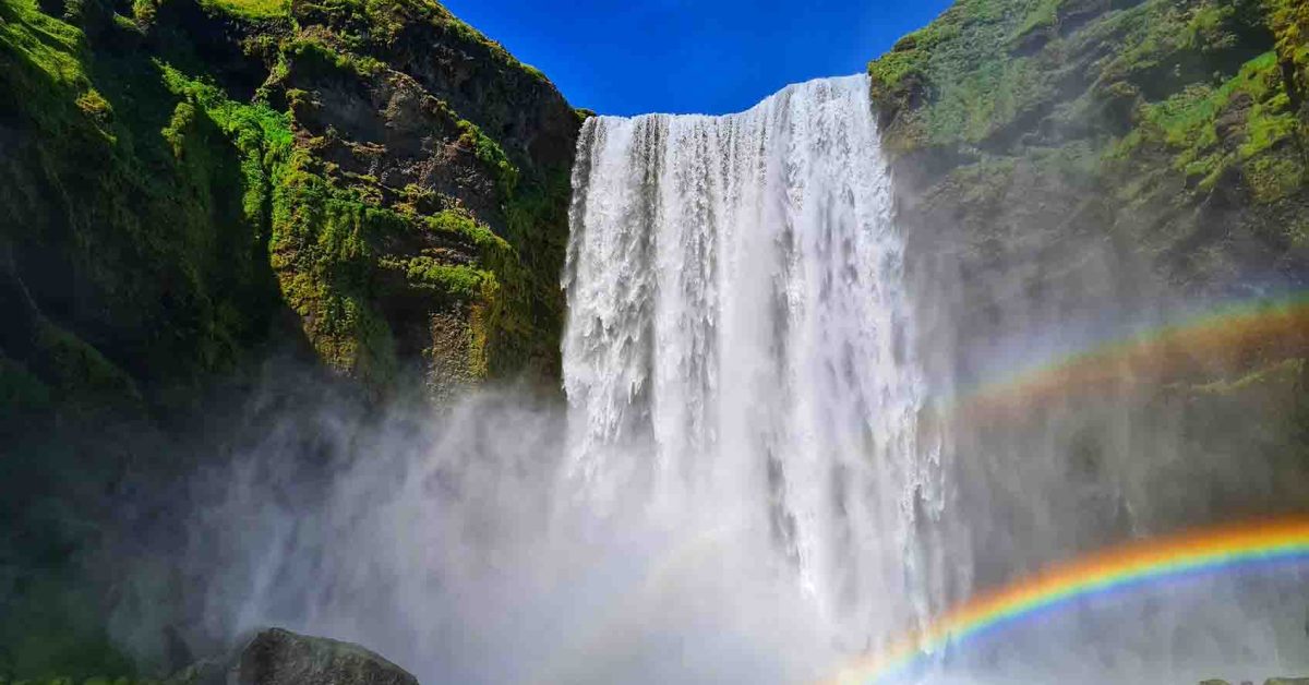
Another landmark and one of the most photographed waterfalls in Iceland is Skógafoss. It is one of the biggest waterfalls in Iceland with a 25 meters’ width and a drop of 60 meters.
Due to the sunlight and the spray that water produces, there are almost rainbows that can be seen on the wall created by the water falling.
The waterfall has its origins in the Skógá River. On this river is a large char and salmon population.

According to legend, the first Viking settler in the area buried a treasure in a cave behind the waterfall. The legend continues that locals found the chest years later but were only able to grasp the ring on the side of the chest before it disappeared again.
The ring was allegedly given to the local church. The old church door ring is now in the Skógar Museum. Believe it or not, if you got close enough to the waterfall you might be able to see the treasure chest.
You can see the Skógafoss waterfall from the top. There is a staircase that leads to the top of the waterfall which is also a belvedere platform.
Also when you wander around Skógafoss respect the signs and do not get too close to the waterfall.
How to get there: Skógafoss waterfall is also visible from Route 1 so it is impossible to miss it. You also have a car park near the waterfall.
Kvernufoss – the little brother of Skogafoss
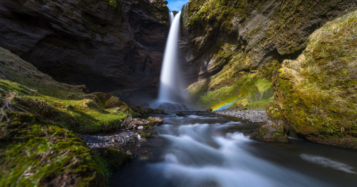
Kvernufoss is a beautiful waterfall located in South Iceland. The water from river Kverná falls 30 meters into the beautiful Kvernugil gorge. During the summer and early autumn, you can walk behind the waterfall where the view of the gorge is stunning.
If you want to visit Kvernufoss during winter, we recommend you not to walk behind because the path will be frozen and there is the risk of injuring yourself if you slip on the ice. Also, there is the risk of falling icicles so you better stay safe.
Kvernufoss is located a 30-minute walk from Skogafoss and the path to the waterfall starts near the Skógarsafn Museum and it is visible through the grass field.
On your way to Kvernufoss, you will have to cross over a fence that has a stair, so you don’t need to worry about this.
Once you get closer to the gorge you will see a glimpse of the waterfall hiding behind the gorge walls, but as you go further, the gorge opens up and the beautiful Kvernufoss will delight your eyes.
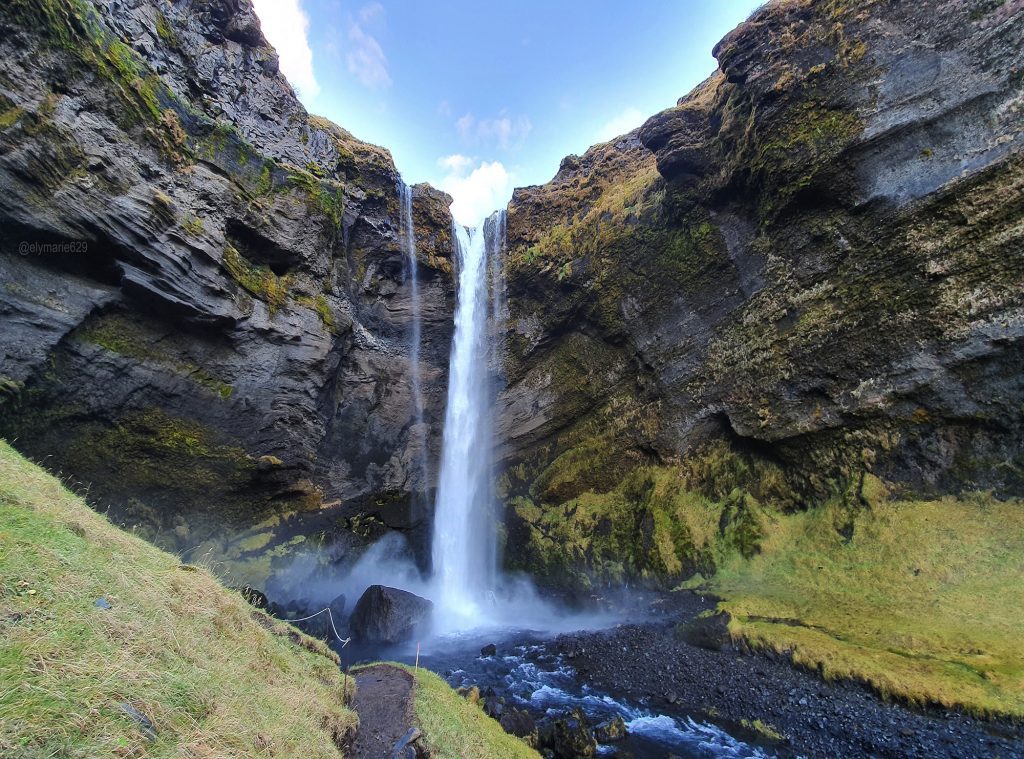
This waterfall might be similar to Seljalandsfoss because you can walk behind the waterfall and also similar to Gljufrabui (which is near Seljalandsfoss) because Kvernufoss is near Skogafoss.
You won’t hear about Kvernufoss in many places because is not included in South Coast tours, but if you are a hidden gems hunter, then you should add this waterfall to your list.
To get to Kvernufoss right from Road 1 you have to turn left when you see the sign for Skogafoss and drive straight until you will see the sign for Skógarsafn Museum which is on the right side.
You can park your car in the museum parking for which you have to pay 500 isk.
Loftsalahellir cave
It may be a cliché, but Iceland is incredible. You will find some breathtaking locations in the last places you could think of. In Iceland, you won’t find unique waterfalls, beaches, mountains, or glaciers but unique caves.
Nature is an artist when it comes to creating caves in Iceland. Best known for blue sapphire ice caves, Iceland will also amaze you with caves formed in the tuff rock.
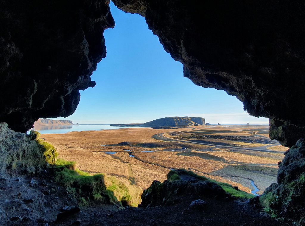
Loftsalahellir cave is no exception. With its unique shape and amazing views, you will want to add this cave to your bucket list.
Located on the South Coast of Iceland on the southwest side of Geitafell Mountain, Loftsalahellir gives you a nice panorama view over Dyrhólaey and Reynisfjara Black Beach that can be seen from a distance.
Before exploring Dyrhólaey and Reynisfjara Black Beach, you should stop at Loftsalahellir Cave and enjoy the view.
The place is less known by tourists so you won’t read about the cave or how to find it on many sites. You have to find it on your own.
Luckily I was there and I can guide you to find this beautiful instagrammable place. You will find Loftsallahellir on your way to Dyrhólaey lighthouse.
Driving south on Route 1 from Reykjavik, you will see a sign to turn right on a secondary road to get to Dyrhólaey. The road is marked as Road 218 on maps.
The cave is on the left side of the road and I recommend you visit the cave after you visit Dyrhólaey because it will be easier to see the cave from the road when you come back to the main road.
There is a little parking space where you can park your car while visiting Loftsalahellir. The path to the cave is visible on the grass field you will have to cross.
Also, on your way to the cave, you have to cross a little river but is nothing difficult. Be careful while hiking to the cave, the path is a bit steep.
Once you are in the cave you will have a nice view of the Dyrhólaey and also a view of the Reynisfjara Black Beach with Reynisdrangar- the basalt rocks that are sitting tall on the shore.
The cave is small but its shape is really interesting as it creates a nice frame when admiring the view from inside.
Dyrhólaey peninsula
The perfect viewpoint on South Iceland’s black beaches
When you travel on the south coast you will find the Dyrhólaey peninsula. Back in the day, Dyrhólaey was an island that joined after the Icelandic mainland. On the peninsula, there is also a historic lighthouse and a wealth of birdlife.
Dyrhólaeyjarviti is the name of the lighthouse that guards the Dyrhólaey peninsula coast and consists of a white square concrete tower. During the night you will be able to see the light flicking to the sea every 10 seconds.
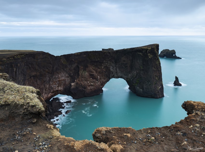
The wildlife of the Dyrhólaey peninsula is represented by birdlife. You will find all-year-round species of Eider Ducks and from May to September you can find puffins.
This is the closest location from Reykjavik where you can see puffins. Sometimes the area can be closed due to the egg-laying season.
From the top of the peninsula, you will have an impressive view over the black sand beaches on both sides of the peninsula, complemented by dancing waves of the ocean.
Also, you can see the creeping glacier, Mýrdalsjökull that hides the Katla volcano under its snowy cover.
How to get there: Going further on Route 1 you will see an intersection and a sign which will lead you to the car parking at the base of Dyrhólaey.
From the car park, you have to hike up to the lighthouse. The path is also marked so it will be easy for you.
Reynisfjara Black Sand Beach
The most beautiful black beach in Iceland
Situated beside the fishing town of Vík í Mýrdal, Black Sand Beach, or in Icelandic Reynisfjara, is one of the most known black beaches on the south coast of Iceland.
Its beauty was recognized in 1991 by National Geographic and it was voted as one of the Top 10 non-tropical beaches on Earth.
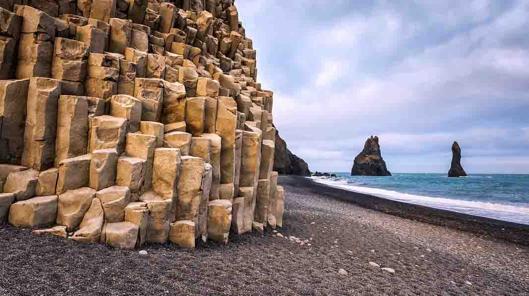
Its enormous basalt columns and ocean waves roaring on the beach attract thousands of tourists every year and also is a must-see for photographers.
You will observe some rocky formations shaped in time by the ocean waves. Reynisdrangar is the name of those formations that are sitting on the shoreline.
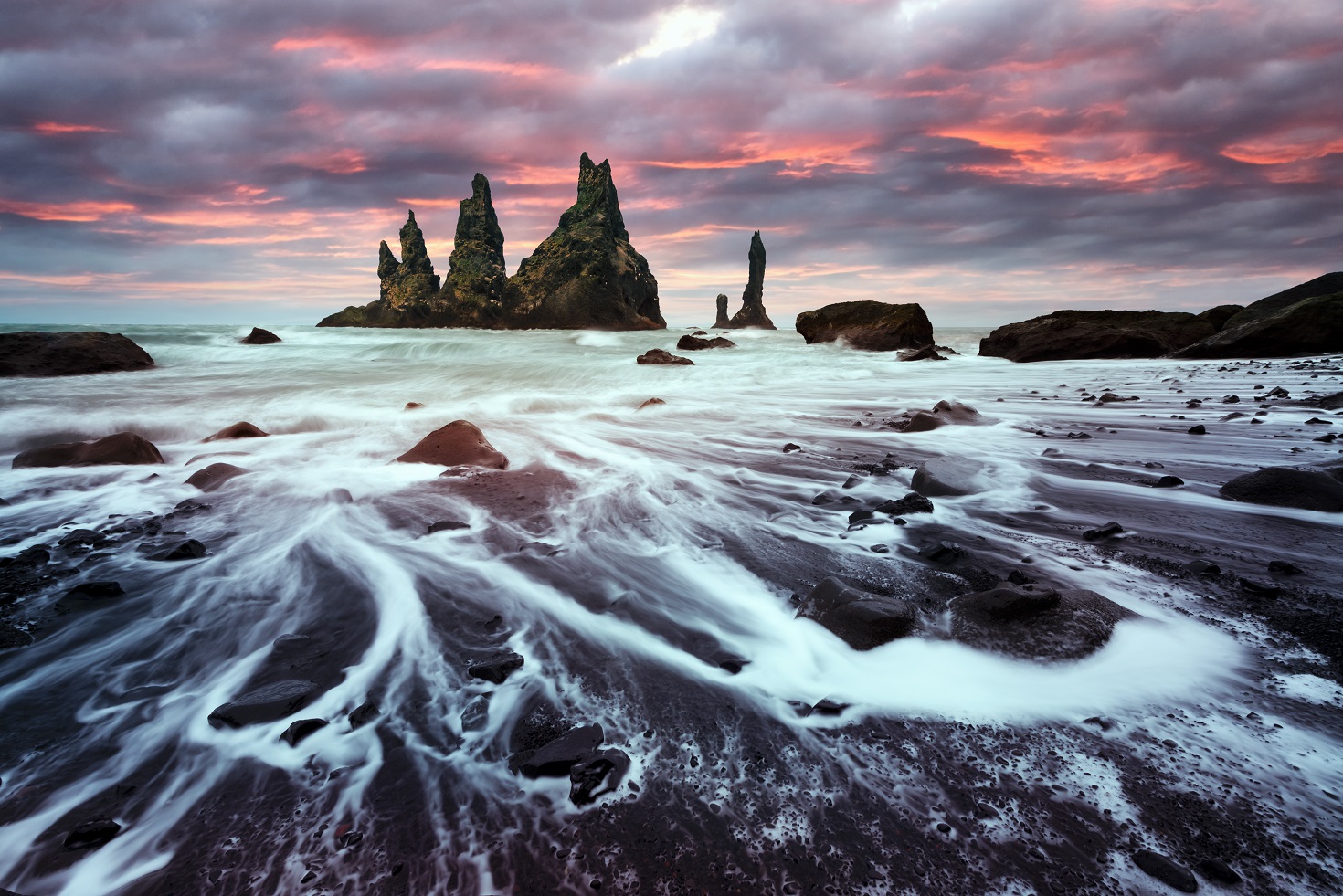
There are some legends about those formations and the basalt columns. In local folklore, these large basalt columns were once trolls who were trying to pull the ships from the ocean to the shore.
Once they went out too late in the night and when the sun started to rise the trolls turned into solid rocks.
About Reynisdrangar, it is believed in the local folklore that a man’s wife was kidnapped and killed by two trolls. Then the man followed the trolls down to the Reynisfjara where he froze them so they could never kill again.
You will see that many locations in Iceland were used in filming scenes of the HBO series Game of Thrones. Also, you will recognize Reynisdrangar from season 7 of the series in the scene ‘Eastwatch-by-the-Sea’.
Being close to the Dyrhólaey peninsula, on Reynisfjara you will also see some species of birds like puffins, fulmars, and guillemots which are usually nesting there.
As beautiful as it is, this beach is dangerous. Ocean currents are powerful and the waves are really strong there. You will find signs everywhere on the beach that tell you to not approach the waves as it can cost you your life.
There were some cases when people died because they got too close to the ocean and the waves pulled them into the water. So be careful and do not put yourself in danger.
Vík í Mýrdal town
One of the most popular towns on the South Coast is by far Vík í Mýrdal. The little town located on the southern coastline is also the southernmost inhabited town in Iceland. You might probably know the picture of the village from the Netflix series “Katla”.
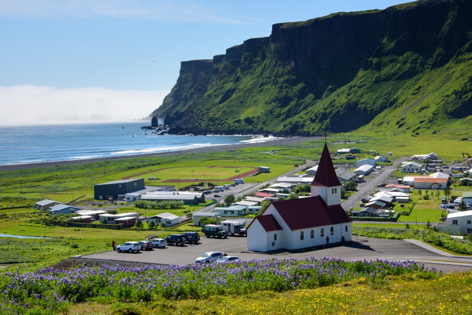
Vík í Mýrdal has a very interesting history and is quite different from the other coastal towns.
The thing that makes Vík í Mýrdal different is that it has no port.
The town of Vík was settled permanently in 1890 once the traders that used to come to the area remained there to sell their products: vegetables, fruits, flour, salt and sugar.
The town became a commercial area and after some time there were open five food stores and two slaughterhouses.
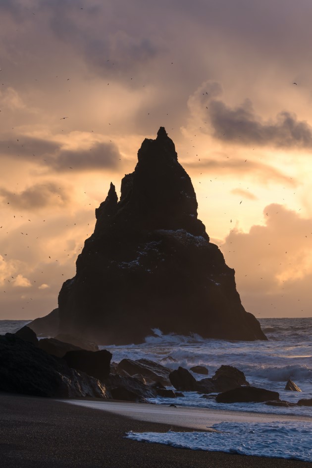
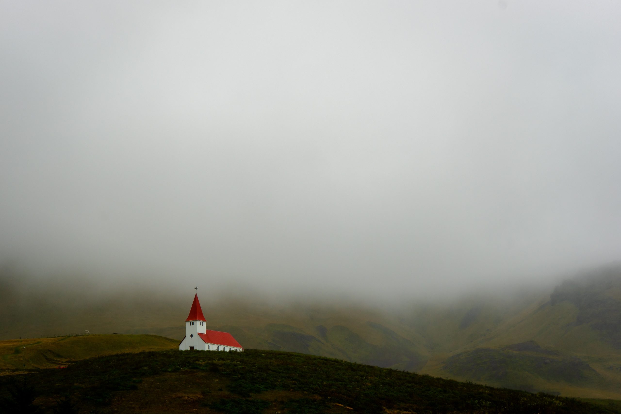
Over time, Vík í Mýrdal became a small settlement and a place where Icelandic farmers used to meet. In 1934 the Víkurkirkja Church was built and from that point, Vík í Mýrdal gained its status as a village.
Víkurkirkja Church is located on a hill that is quite above the town and from there the view over Vík is stunning. People say that in case of an eruption of the Katla volcano, the church will be the safest place because the rest of the town will be flooded by the waters from the Mýrdalsjökull glacier.
The community in the town was very small and nowadays is no larger than approximately 300 people. Vík í Mýrdal is a famous stop for tourists because of its location on the Ring Road and the fact that is the only larger settlement in the area.
The next town is about 70 km away from Vík. It is also the ending point for many day tours on the South Coast.

Vík í Mýrdal is surrounded by very well-known places such as Reynisfjall Tuff Mountain with the Reynisfjara black sand beach and Reynisdrangar on the west and south part. Katla Volcano under the Mýrdalsjökull glacier is guarding the town on the northern part and the Myrdalur Cliffs to the east.
The area of the town has also rich wildlife and during summer there can be spotted arctic terns on the basalt cliffs of Reynisfjall and puffins on the Dyrholaey peninsula. Sometimes there can be spotted seals, dolphins or whales in the waters around Vík.
As I already mentioned the town of Vík í Mýrdal is an important and famous stop for tourists as you can find there important places to supply while on your within Iceland.
You will find there a gas station, a supermarket Kronan, an alcoholic drink shop Vínbúðin, a local clothing shop Icewear, some restaurants, cafes and hotels.
Svartifoss – the black waterfall
The Black Waterfall in South Iceland
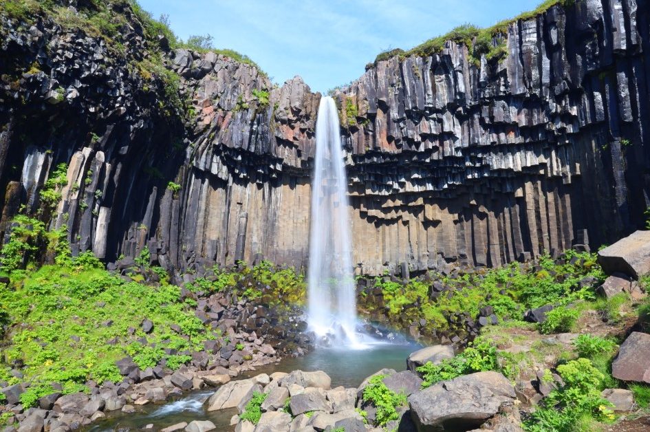
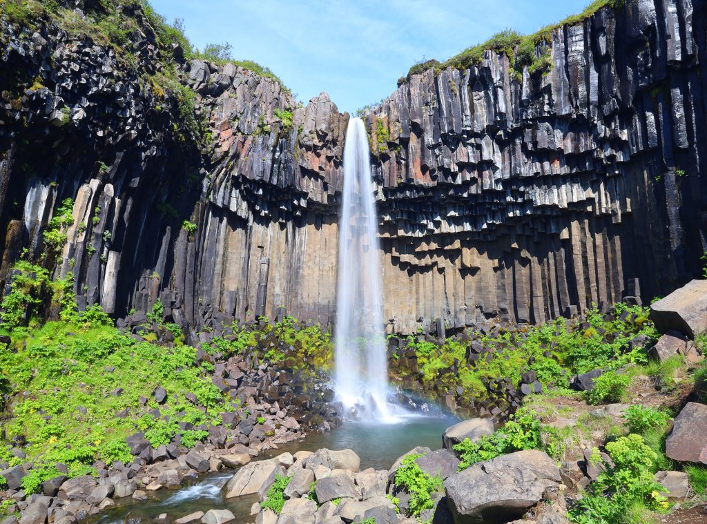
While wandering in South Iceland, you can go to Skaftafell National Park to see the Svartifoss waterfall. A 20m (80ft) tall waterfall fed by the ice-cold water from the Svinafellsjokull glacier.
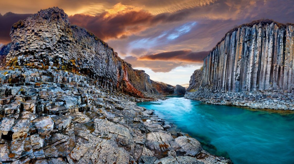
The name of the waterfall translates to ‘Black waterfall’ given by the colour of the basalt columns that stand tall and form the cliff.
Icelanders say that the natural architecture given by the basalt columns from this waterfall inspired the architect Guðjón Samúelsson who designed Iceland’s National Theatre and the Hallgrimskirkja church in Reykjavik.
The basalt columns formed from a lava flow which cooled slowly and formed the hexagonal shape.
To get to the Svartifoss waterfall, you have to hike from the Visitor Centre in Skaftafell where you can also find information about the waterfall and the National Park. The hike will take about 45 minutes one way, about 1.6 km to the waterfall.
Along the trail to the waterfall, you will find three small waterfalls – Þjofafoss, Hundafoss, and Magnusarfoss. Near the Svartifoss waterfall, there is a small bridge across the river. The hike to the waterfall is free but you will need to pay for parking at Skaftafell National Park.
Once you get to the waterfall, you can go as close as it is safe to take pictures of the waterfall without crossing the boundaries set up by the park.
On the way back if you choose to cross the bridge by Svartifoss, along the trail you will find Selið turf houses which are built in southern style. The locals say that those are the few turf houses that remain in South Iceland.
Skálafellsjökull
Tips and directions to Skálafellsjökull
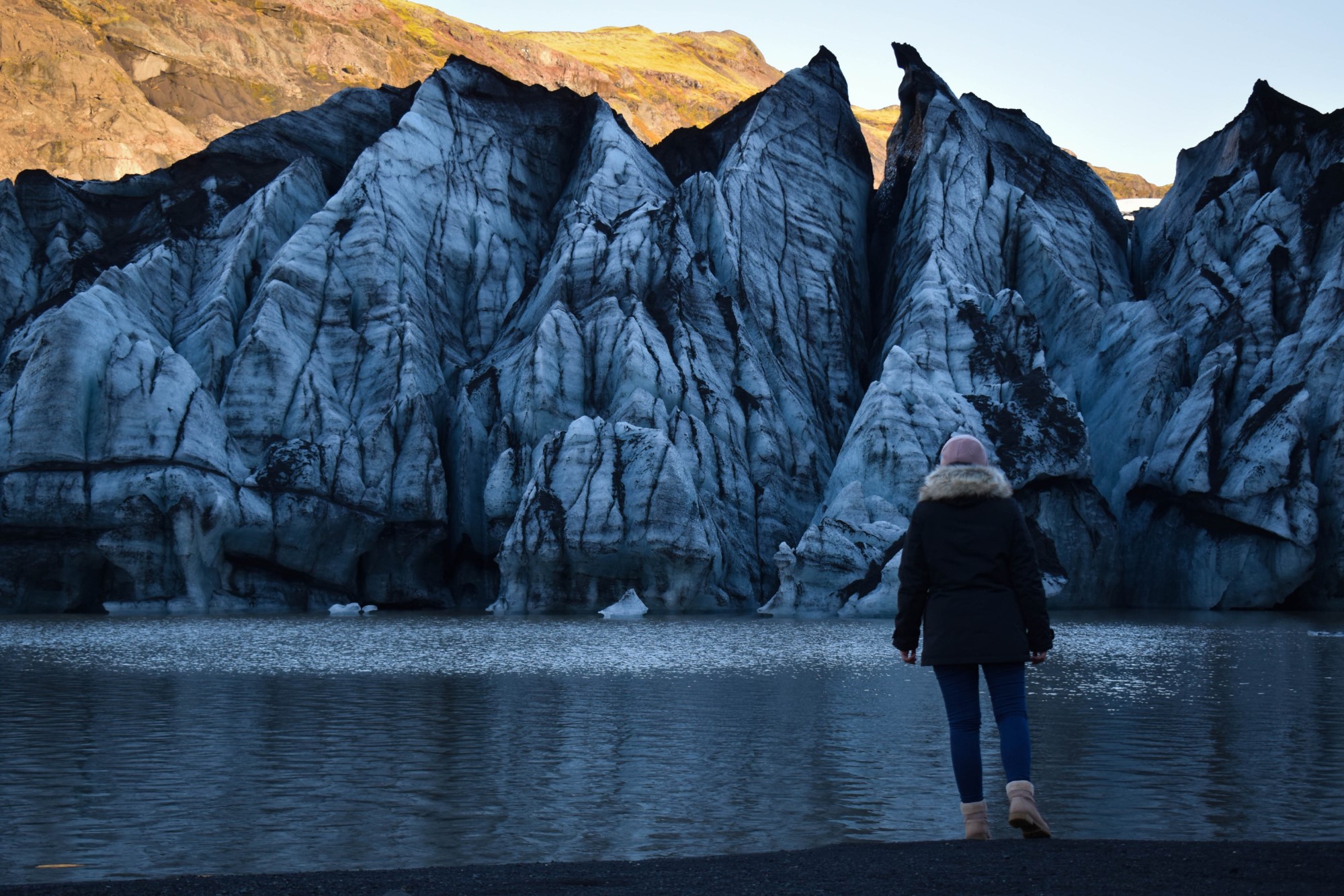
Skálafellsjökull is one of the glacier tongues of Vatnajökull, the largest glacier in Europe. Skálafellsjökull is located between Breiðamerkurjökull and Heinabergsjökull in the south-eastern part of Iceland.
This glacier tongue is kind of unique. For most of the glacier tongues, you see them from the front, across the glacier lagoons.
But for Skálafellsjökull, the front is not accessible as it is cut off by a river from the adjacent glacier lagoon. The good news is, you can drive up to it and see it from the top.
You will need a 4×4 vehicle to drive this road (F985). It is not advisable to drive this road when there is snow as the road is quite steep and snow makes it very dangerous. It is quite a long drive up but it is worth it.
The view all along the road is fantastic with several waterfalls along the way and when you come towards the end of the road, that is when Skálafellsjökull will come into view.
On days with clear skies, you can see almost the entire glacier tongue of Skálafellsjökull and the mountain peaks Hafrafell & Litlafell.
If driving up the mountains is too much for you, you can always join The Secret Glaciers of Vatnajökull tour. This is one of the secret glaciers that we go to when the weather is good.
Alternatively, there are also glacier walks and snowmobile tours that go to this glacier.
Múlagljúfur Canyon
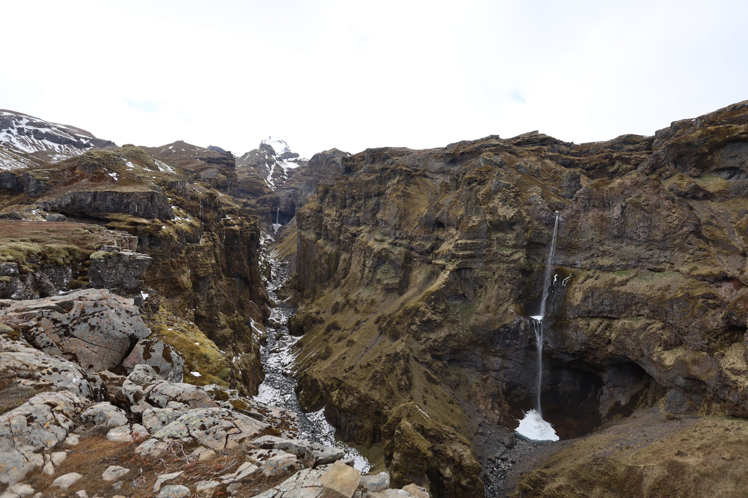
Múlagljúfur Canyon or ‘Mules Canyon’ a hidden gem in South Iceland
When visiting the South of Iceland, many people turn their attention to the most known locations like Black Sand Beach, Diamond Beach, or Jökulsárlón Glacier Lagoon.
But how about exploring some hidden gems like Múlagljúfur Canyon? Although many hidden gems in Iceland become popular, this one is not so known by tourists.
The location of the Múlagljúfur Canyon can be found on Maps if you type the name of the canyon or if you introduce these coordinates on GPS: 63.98877960616354, -16.394959472827694.
Despite that, you won’t find any marks or indicators on the road that leads to the canyon. The canyon is located near the Fjallsárlón lagoon, in the south part of the glacier tongue.
If you go south from the Glacier Lagoon on Road 1 you will cross two rivers. After the second river, you will find a gravel road on the right leading you to the parking area at the mountain’s base. The parking area is not marked but you will figure out that you can park there.
You will need a 4×4 car because that gravel road might be flooded by the river fed by glaciers or rainwater during summer and snow-covered during winter.
Although it might be an all-year activity, I would recommend going there during the summer or from May to September depending on the weather, because the path that leads to the top is a bit steep on some parts and if you are not careful it is possible to slip on the edge of the rock.
In some spots, the path is covered with rubble and can be very dangerous if it happens to slip. I would recommend also going there only if you have good knees and back.
Once you get to the parking spot, you will see the path contoured right from the parking. The path is also marked with small sticks so if the path is not visible you have to look for the sticks.
Also, on the path can be roots, mud, and stones but nothing that is not manageable.
On your way to the top, you will have to cross two small rivers that are quite easy to cross. Sometimes, those rivers might be bigger but you will still be able to cross them.
The hike will take about 35 to 60 minutes depending on your physical condition and depending on the weather. It is classified as a moderate difficulty hike but trust me, it will be worth all the effort.
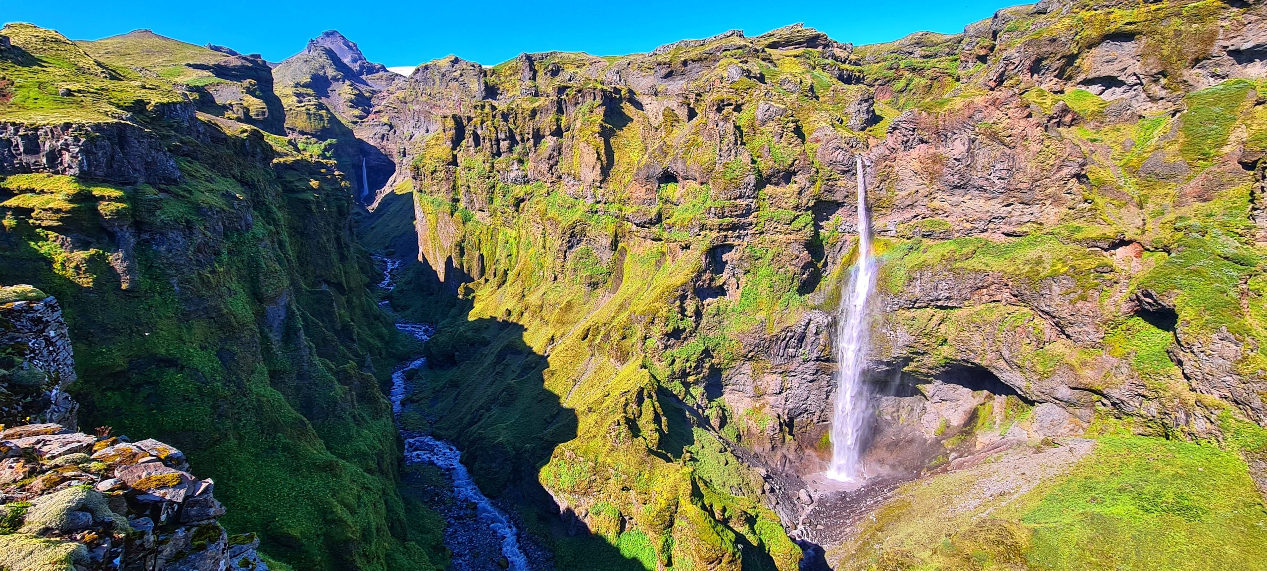
Following the path to the top, you will start to see a glimpse of the canyon showing up in front of your eyes. If you turn around you will have a panorama view of the Fjallsárlón lagoon and part of the glacier as well as a panorama view of the area of Jökulsárlón Glacier Lagoon and Diamond Beach.
Along the path, you will see the Múlafoss waterfall and while you are closer to the top you will see the Rótarfjallshnúkur peak (1.848m) guarding the whole canyon. You will spot a lot of birds flying from one side of the canyon to another and hear the sound of the waterfalls.
Be careful and do not go to the edge of the cliffs, do not step on the rocks as they are unstable and it is very dangerous. Also, respect nature and do not leave trash on the mountain. Do not risk your life for a photo! Sit down and enjoy the view!
Jökulsárlón Glacier Lagoon
Also named The Crown Jewel of Iceland, Jökulsárlón Glacier Lagoon is one of the most visited places in the country and one of the most famous.
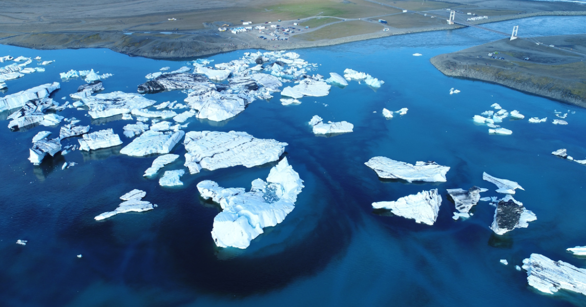
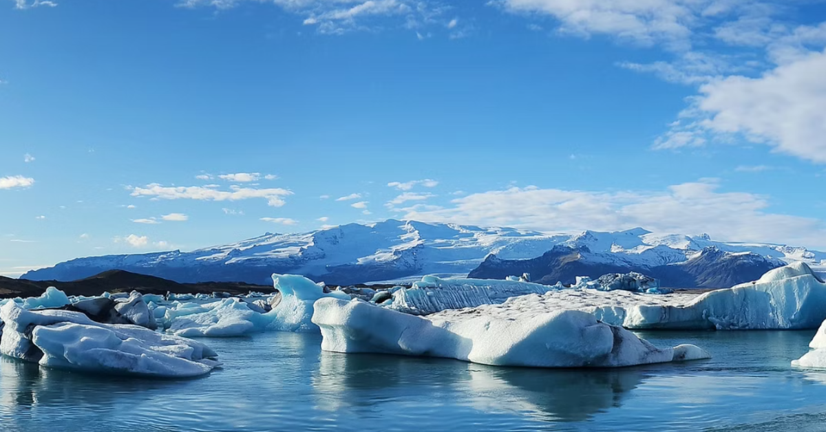
As its name says, it is a lagoon formed by the melting water from one outlet glacier of the biggest glacier in Europe, Vatnajökull. Located in the South-East part of Iceland, Glacier Lagoon is the stopping point for all travellers who are visiting the South coast or are driving the Ring Road.
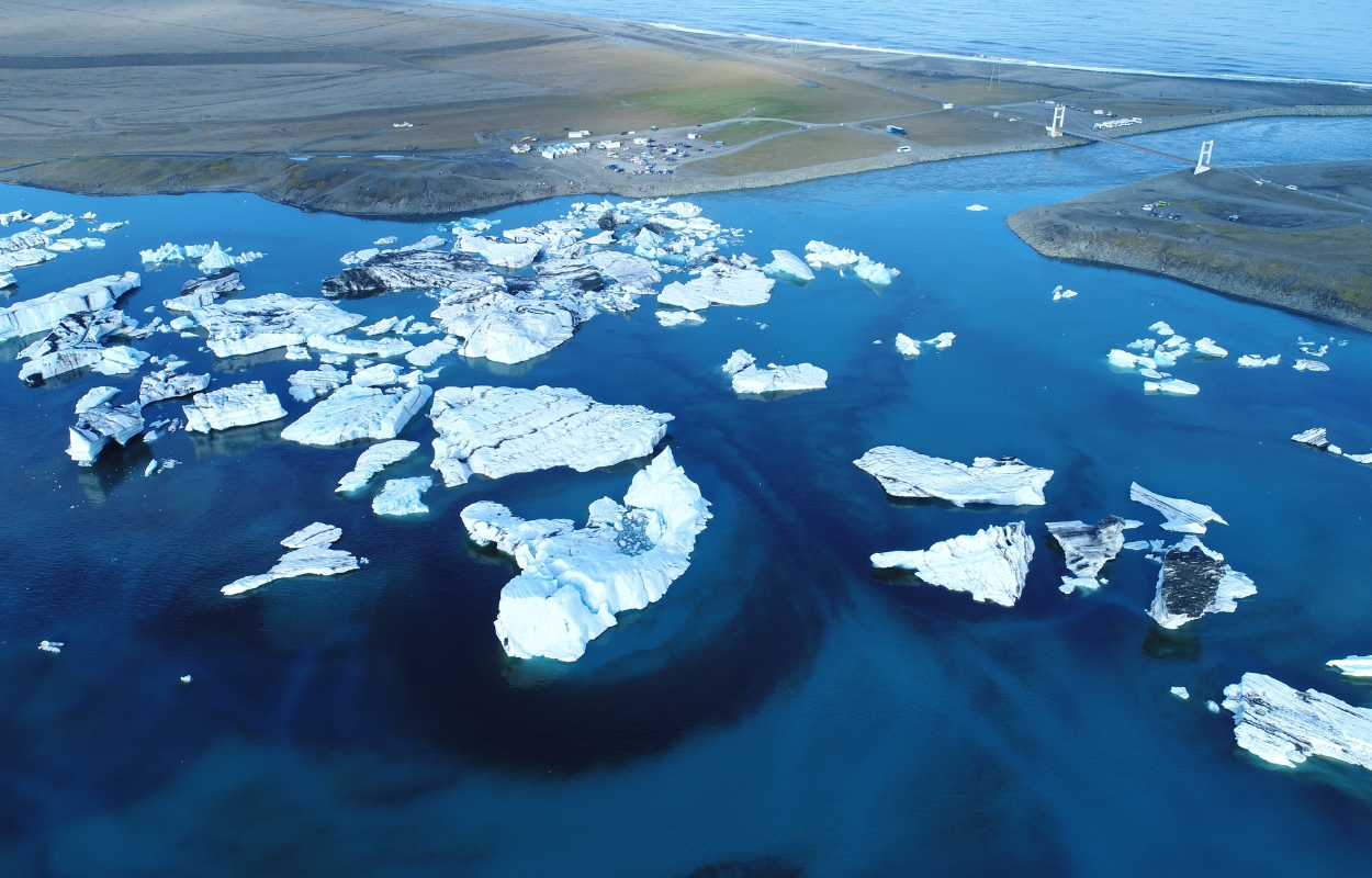
The outlet glacier that feeds the lagoon is named Breiðamerkurjökull and the lagoon formed quite recently, around 1935 when the climate started to warm and the glacier melted under the high temperatures.
Scientists say that Breiðamerkurjökull started to melt around 1920 and is continuing to melt nowadays. They believe that the glacier will melt until the lagoon will become a large fjord.
What makes the lagoon special is the big icebergs that were detached from the glacier tongue and drifted to the ocean. Because of the ocean currents, the waves are taking the ice pieces back to the shore.
The Jökulsárlón Glacier Lagoon is also the deepest lake in Iceland with 248 meters (814 feet) depth. Its surface is continuously growing and its current surface is about 18 square kilometers (7 square miles).
The fame of the lagoon has crossed the borders to Hollywood and film producers considered the lagoon at Jökulsárlón the perfect place for filming some scenes.
The most famous movies that have scenes filmed there are James Bond A View to Kill (1985), James Bond Die Another Day (2002), Lara Croft: Tomb Raider (2001), and Batman Begins (2005).
You can find more about the movies that have scenes filmed in Iceland in our blog about the most famous movie locations in Iceland.
Jökulsárlón Glacier Lagoon is also home to some bird species as Arctic Terns and Skuas that come for breeding during summer.
Also, the amount of herring and capelin that are brought to the lagoon by the tides attracts many birds that lying on the icebergs ready to get their food.
Mostly during the summer, you will find at the Glacier Lagoon many seals swimming in the glacial water of the lagoon or lying on the icebergs.
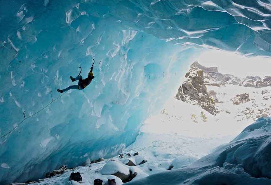
The Glacier Lagoon is not only a place to stop and admire the beauty of Icelandic nature but also a place where you can do some interesting activities like exploring the Blue Ice Cave during winter or boat tours on the lagoon during summer.
You will find all the details for those activities on our blog dedicated to the activities at Jökulsárlón Glacier Lagoon.
Jökulsárlón Glacier Lagoon is one of the most changeable places in Iceland, every time you go there you will have a different view over the lagoon. The lagoon is part of the Vatnajökull National Park and because it is a fragile place it is also protected by Icelandic law.
Please respect nature and protect it. Despite the amazing place that Glacier Lagoon became, we have to be aware of the climate changes as the lagoon is a consequence of it and the melting glaciers and one of the most visible proofs we can have.
There are many Self-driving tours and Private tours that include a stop at the Glacier Lagoon and we highly recommend including this amazing place in your itinerary. You can also design your itinerary together with our travel designer.
Breiðamerkursanður (Diamond Beach)
Probably the most known and the most Instagrammable black beach in Iceland, Diamond Beach is the most beautiful black beach in Iceland.
Going to the South-East coast of Iceland, near the famous Jökulsárlón Glacier Lagoon you will find the most famous black sand beaches in Iceland, Breiðamerkursanður or Diamond Beach as it is known by tourists.
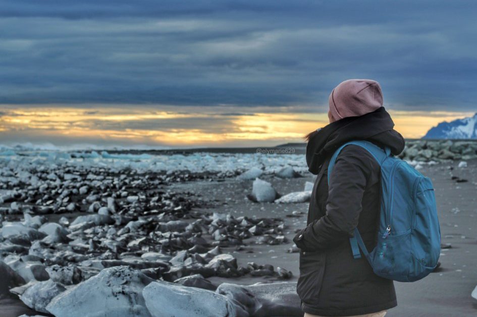
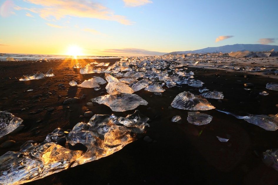
Diamond Beach is a black sand beach woven by ocean waves with many beautiful ice blocks which slipped from the lagoon into the ocean.
If there is a sunny day, ice blocks will reflect the sunlight just like there are diamonds on the beach. That is actually where the name of the beach came from.
But if it is cloudy outside and the wind is blowing, you will see how the waves break into the large blocks of ice and create spectacular views. Do not adventure close to the water if there are waves, it might be quite dangerous.
Diamond Beach has its charm. It changes almost every day as the ice blocks may melt, break or be carried away by waves. So you will get a different landscape every time you visit it.
During winter you may not see every time so many ice blocks or big ice blocks as the glacier is frozen in the cold. But during summer you have the chance to see enormous ice blocks on the beach.
All those adventures can be accompanied by a delicious Icelandic meal in one of the many beautiful restaurants across the country. For the South Coast of Iceland, we have some recommendations for you.
If you used our guide for planning your trip or to explore these gems on the South Coast, then share your adventures with us on our social media.
Have a great time exploring the Icelandic South coast!


